The Awa Adventure Run (inaugural)

Date: 28 September
Distance: 22.6km
Time: 3:50

A new event on the running calendar is always exciting. The website stated that it is run in a mountain bike park, called That Place, and that the elevation is 1130 metres for the longest distance. Which is of course the one we went for. What’s the use of driving 100km if you are only going to run 14km or 7km. The elevation should have been a warning sign, but who is scared of a little hill.

I am tired of making excuses for my ‘bad performance ‘. I’m tired of being slow. I’m tired of feeling like I’m never ever going to be fit again. On the up side, even though I’m not one of the quickest runners around, I still finish what I start. So far.

Admittedly I’m in a bad place running-wise. We battle to get into a proper routine, and every time things start to look like there’s progress, the weather turns super nasty (which is a lot of the time), or life just gets out of hand. It is an endless battle of stop-starts, and I can only hope that things will get better again one day. Running is one of those things that you cannot do haphazardly – routine and consistency is key. And to add injury to insult, I cannot stop eating junk. Coupled with generally just eating too much.

Nevermind. There will be better days again.

As mentioned this run takes place at That Place mountain bike park. It is privately owned, twenty minutes upstream from Whanganui on the Kaiwhaiki Road. We arrived early to find only a handful of other cars. My initial thought was that it would be a very small event. Especially since the school event already took place the previous day.

Walking around in the wet paddock (to register, to use the portaloo) my feet was already wet and we had’t even started yet. A friend swapped his shoes out to keep the pair he would be running with, dry. This made me wonder how muddy or wet the track might be.

It was a beautiful day, and although cool at the start, it quickly warmed up. We lined up for race briefing, and then were sent on our merry way, making our way up the mountain right from the start. But it was not as simple as that. Although we were generally speaking going up, it was on a track that goes up and down and up and down all the way. Fortunately not as bad as is usually the case with bike parks – these ups and downs are decent, not silly little bumps in the road. Once at the top (was it the top?) we passed some ponds, and also started running on forestry roads.

There’s one aid station on the mountain. An aid station that put anything on a lot of other events to shame. It was unmanned, but luckily most participants were polite, closed the containers so that the lids didn’t blow away, and generally didn’t make a mess in/around the food. There were chips/crisps, marshmallows, jelly sweets, and containers with water. Lots of it. You pass this aid station twice. Once before heading down the mountain, and once after getting back up that bugger of a hill. But I’m getting ahead of myself.

Shortly after the aid station, a viewpoint over the valley made me think that we were looking down from the Skyline Track, which was obviously not the case as the Skyline Track is further upstream. But the river also formed a near circle with an ‘island’ in the middle.

After some running on undulating gravel roads, we started heading down the mountain on a grassy single track. Being wet made it slippery and no sooner did ‘slipping’ cross my mind, when Gerry landed on his arse. Luckily no damage done, and we could carry on down the steep downhill. These were also too steep to run. Whether going up or down, the incline was challenging to run on. At least for me, in my current state. Others were of course flying down the mountain.

This was also the point at which the camera clapped out. Despite cleaning the lens multiple times, it still looked like it was fogged up. Humidity must have got into the camera somehow.

Once we were finally down the mountain on the river’s level again, we had to make our way back up the steepest and longest hill of any event we’ve ever done. One and a half kilometres of relentless uphill that took me nearly half an hour to complete. Not a single step is level or down, each one is on an incline. My calves were screaming, and my unfit heart and lungs didn’t do any better.

Once back on the mountain, finally, we stocked up at the aid station again before slowly making our way down again where it levels out for the last few kilometres next to the awa. The website gave the elevation gain as 1130 metres, but we measured around 750m. Either way, it is very hilly.

I guess it’s fair to say that a lot of it can be described as undulating, while going uphill and downhill. But to me it was too steep to run. I’m just not in a place where I’m even just a bit comfortable on hills.

Once we were back at the finish (about five metres away!) we were directed in the opposite direction to cover another 1.5km. That was just nasty, but to make the course at least a half marathon, it had to be done. By then I had long given up on running of any kind. In fact about 3km earlier I already gave up the ghost and started to walk. The one part that was totally runnable and flat, was the part I had to walk.

Finally at the almost deserted finish (there were only two others behind us), we got our medals, changed into dry clothes, and made our way back home.

Spring has not been kind to us so far weather wise. It rained heaps and often the wind would blow a gale. But we were very lucky to have had good weather at all three of the events we did in September. Those were just about the only good days of the month.

Now, if only I can get into a routine of sorts and run most days of the week.

Baldwins Bluff Trail

Date: 16 June
Distance: 10km
Time: 1:30

After our parkrun, we visited some art galleries in Perth, had lunch, washed down with beer/cider at Picabar, bought some food for two days, before heading south out of Perth. It was about an hour’s drive into the ‘heart of the captivating Darling Ranges’, when we arrived at the Serpentine Falls Tasman Holiday Park where we stayed a couple of nights. It was already late afternoon, so we poured a glass of vino and started with dinner.

During the night I thought I heard raindrops. But in the morning it was sunny and another gorgeous day greeted us. Rain was forecasted, so we decided to drive the scenic route through the Serpentine National Park. By 10am it was clouded over and a soft rain started to fall. At the historic town of Jarrahdale we stopped at the Jarrahdale Local PO Kitchen for coffee and lemon tart. The air smelt clean and everything was covered in a shiny wet layer. Tourists, locals and a biker gathering had the cafe buzzing with patrons on this Sunday morning.

The narrow road winds it’s way through eucalyptus (jarrah), in red and rocky soil. I was surprised to not have seen a echidna yet. The environment reminded me of our first venture into Australia (Tasmania) when we saw our first echidna. I was intrigued to read about their 4-headed penises (which are not used to urinate!).

A few more sightseeing stops in the rain, including a visit to the Serpentine Dam, and we completed the round trip back at our accommodation for lunch.

Gerry had to finalise his poster for the conference, and as soon as that was done, we went for a jog-walk to Serpentine Falls and the Baldwin Bluff trail. It was nearly half-4pm, and the sun would be setting in a couple of hours, which was a minor concern. But not enough to deter us.

From our accommodation it is 1.6km to the parking area. We walked the first kilometre which was next to the road, before starting on a slow jog into the park. From the parking area we jogged the 400 metres to the falls where massive swimming holes are located. The water was dark and looked eerie, but clean and almost inviting (if you’re that way inclined). Strangely enough, we are five days out from the shortest day of the year, and the temperature was warm and comfortable (19 degrees C). I can imagine people might go for a swim, even at this time of year.

After the quick in and out to the falls, we took on the Baldwin Bluff Trail which went in the opposite direction from the falls out of the carpark. It is a 6km trip out-and-back, meaning the first three are mostly uphill. There were bits of downhill and the last kilometre was flat-ish with just a minor ascent, totally runnable.

Underfoot was quite rocky, and my old self – watching out for snakes underfoot – kicked in immediately. There were a number of other people making their way up the hill, but mostly people were coming down the track back to the carpark, as it closes for vehicles at 5pm. We were huffing and puffing going uphill to the lookout as fast as we can. With all the action, snakes would presumably have scurried away anyway.

At the far end, we saw a pademelon pair grazing on the foliage. We could see the campsite where we stayed down below in a distance, about 5km away (only two as the crow flies).

We started on the downhill, which went a bit quicker than going uphill, although the tripping hazard slowed me down to the occasional walk. We reached the completely deserted carpark at around 5pm, and had a sip of water before heading out of the park. The last kilometre (as with the first one) we walked along the road from the park gate back to the accommodation.

It is a lovely trail, and I’m happy we could fit it in before dark.  

Race Tekapo

Date: 16 September 2023
Distance: 50km
Time: 7:51

During the week leading up to the event, we followed the weather predictions closely, and things were looking increasingly grim. When an outing like this starts to get into the thousands of dollars, you don’t want anything to derail your plans. Winds of up to 100km/h (130km higher up the mountain) and a possibility of rain starting from 1pm were in the forecast for the event, according to YR. MetService had the rain starting at 4pm. We had all our compulsory gear, plus a few more layers (yes, I’m a wuss when it comes to extreme weather), and were crossing everything for not too bad weather.

The trip down was fine, but exhausting. We flew from Wellington early on Friday morning, so had to get up at 3:40am to drive down well in time. The wind was blowing like no tomorrow the day and evening before, and I was worried trees might be down/on the road, increasing our travel time. Fortunately nothing of the sort, and we could drive down in good time. The wind was still very strong, blowing our little car across the road, and I was stressing about the flight. I’m not a big fan of turbulence or sideways landings, but when we reached Wellington, it was calm and beautiful. I could not be more relieved. The flight was okay, a little bit of turbulence, with a decent landing in reasonable windy conditions, as Christchurch was more windy than I hoped.

When we walked out of the airport, the temperature was already a few degrees cooler than Wellington and Palmy. The rental car guy picked us up at the airport and drove to their place to sort the paperwork. Once we were on our way, we made by a quick trip to the supermarket for some last food stuffs, before making our way to Lake Tekapo. It is about a three hour drive and we were hoping to take it easy, stopping along the way, and not feel too rushed. It was about 10am when we left Christchurch.

Not a whole lot was happening along the way, and not many towns to stop for coffee or a breakfast. Most places were still closed. Fairlie, on the other hand, was bursting at the seams with queues out the door at some eateries and coffee shops. After a walk through town to find some hot chips and coffee, we eventually gave up and decided to stick to the bread, cheese and salami we bought at the supermarket. Why does one always want something other than what you have on hand?

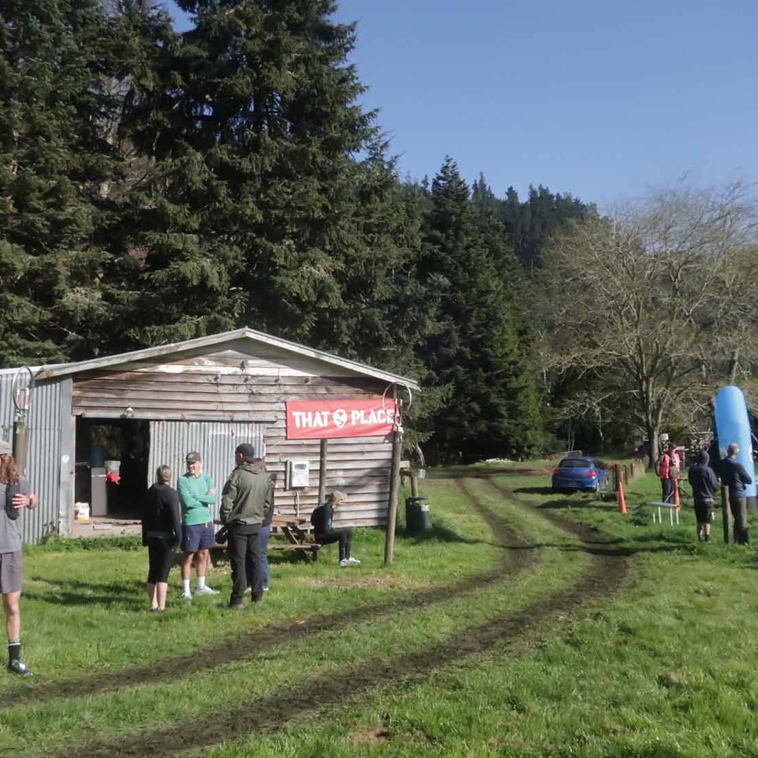
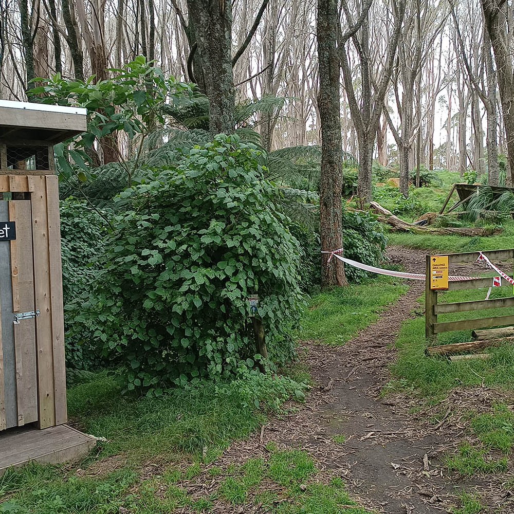
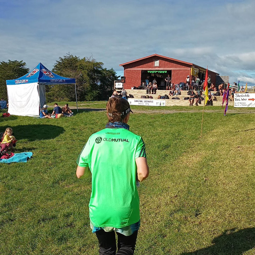
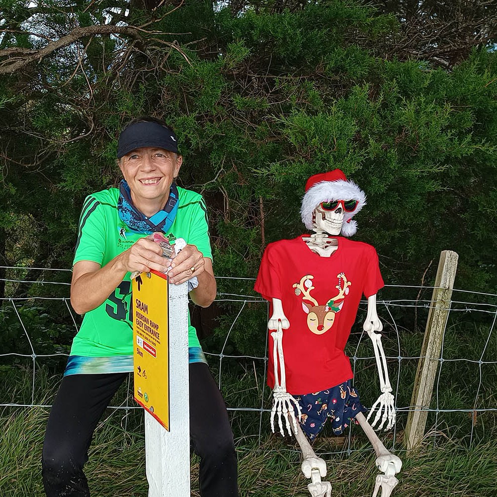
We arrived at our accommodation at about 3pm, checked in, got our gear ready, and walked the 750m to the event registration. Registered and with a bib, goody bag which included a race branded Thir headband (!), our compulsory gear checked and drop bags dropped off, we made our way back to the lodge as it was starting to get dark. While cooking dinner, we shared a cider, and cranked up the heaters.

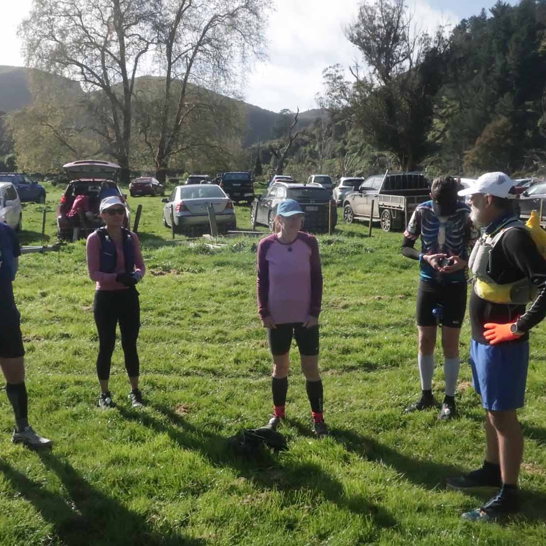
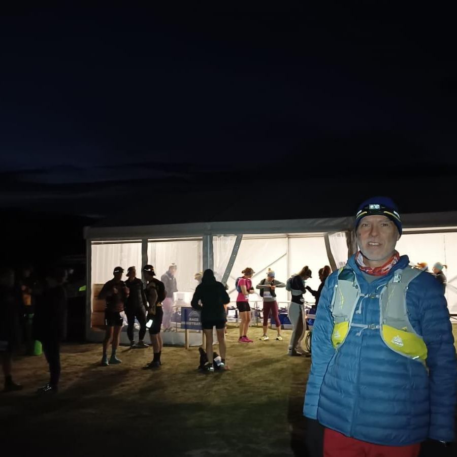
The temperature was already in the single digits and dropping though the night. Prediction was for minus one at the start of the race. When we got up, yet again before 4am, it was one degree Celsius. But the best part was there was almost no wind! It was obviously going to pick up sooner rather than later, but our 1.2km walk in the dark to the start was just very cold, not super duper cold from wind chill.

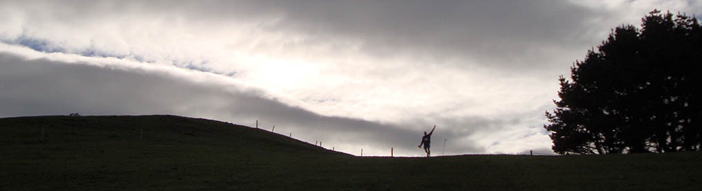
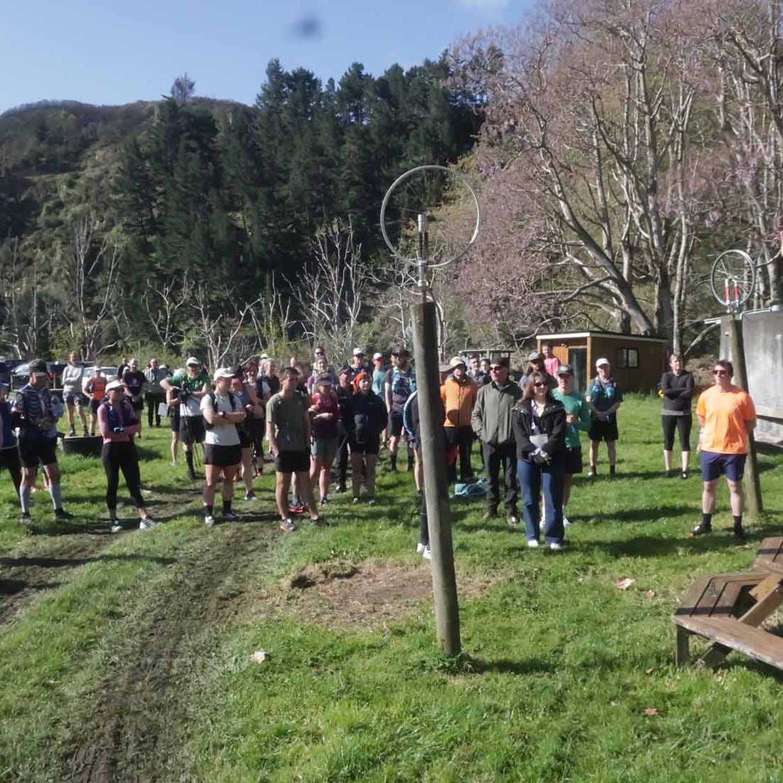
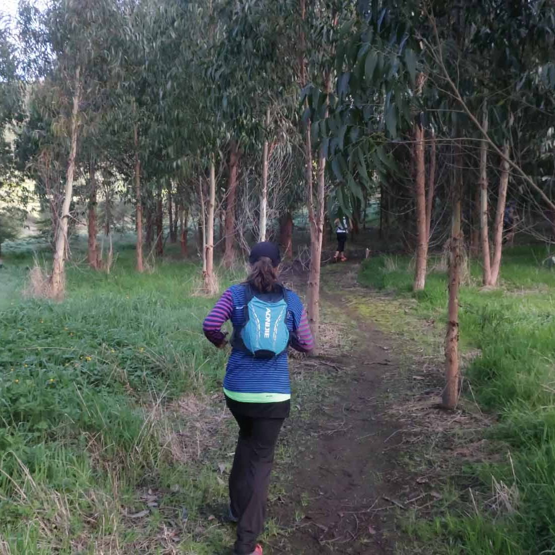
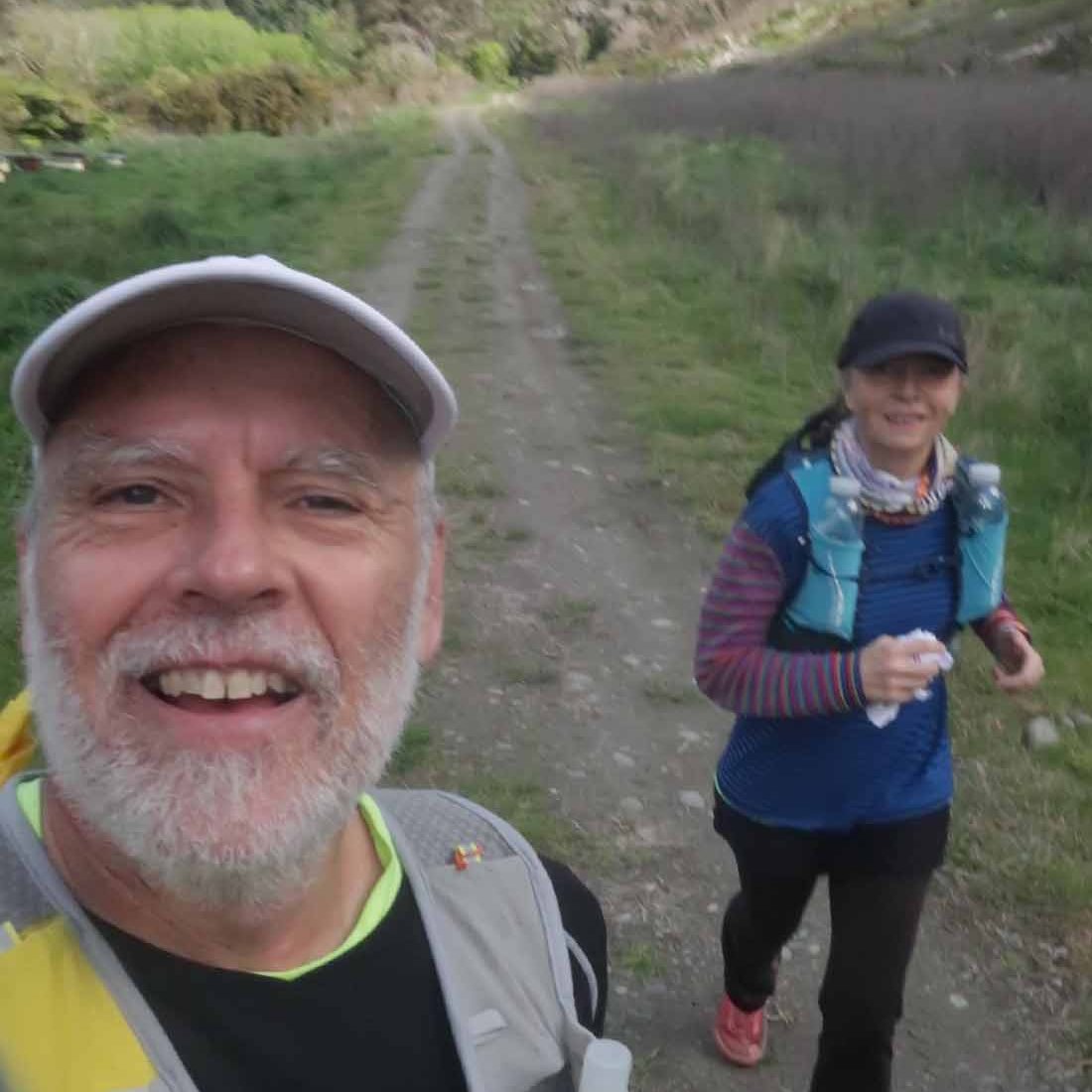
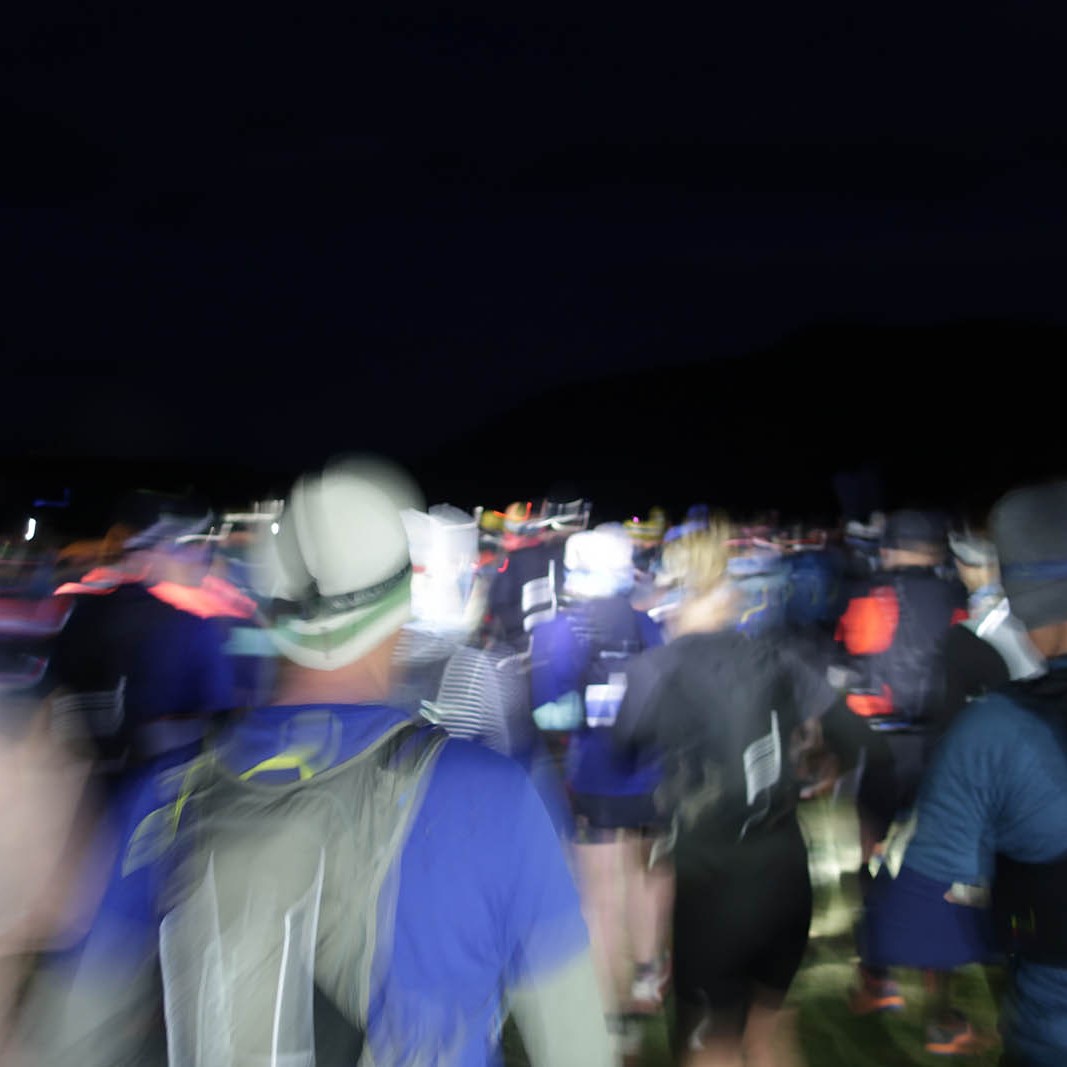
Race briefing was at 5:40am, and at 6am on the dot we were off – to the theme music of UTMB: Vangelis’ Conquest of Paradise. Haha. That was quite funny, but for the first few kilometres I was humming the tune in my head thinking, dreaming, about doing the UTMB one day.

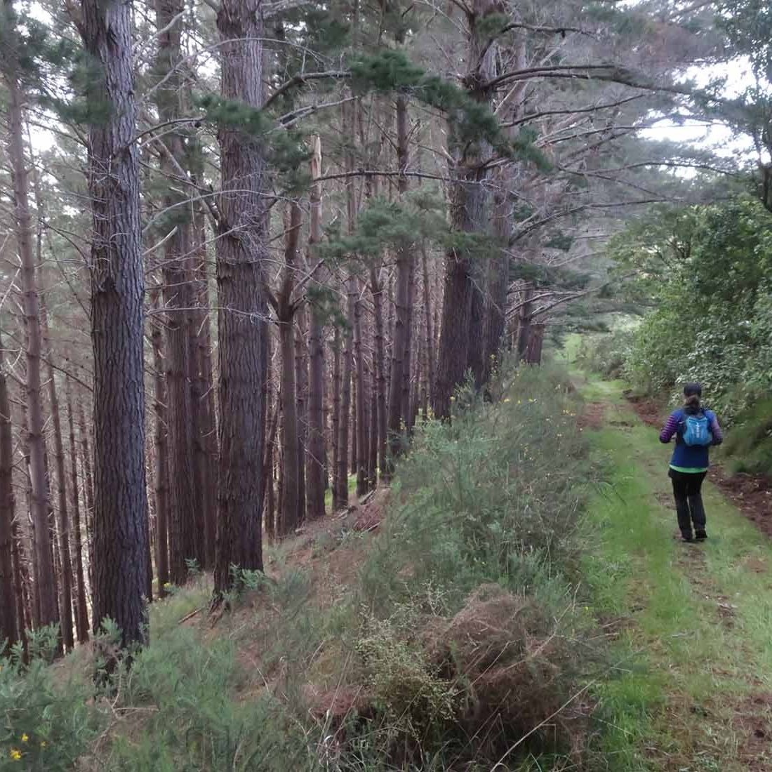
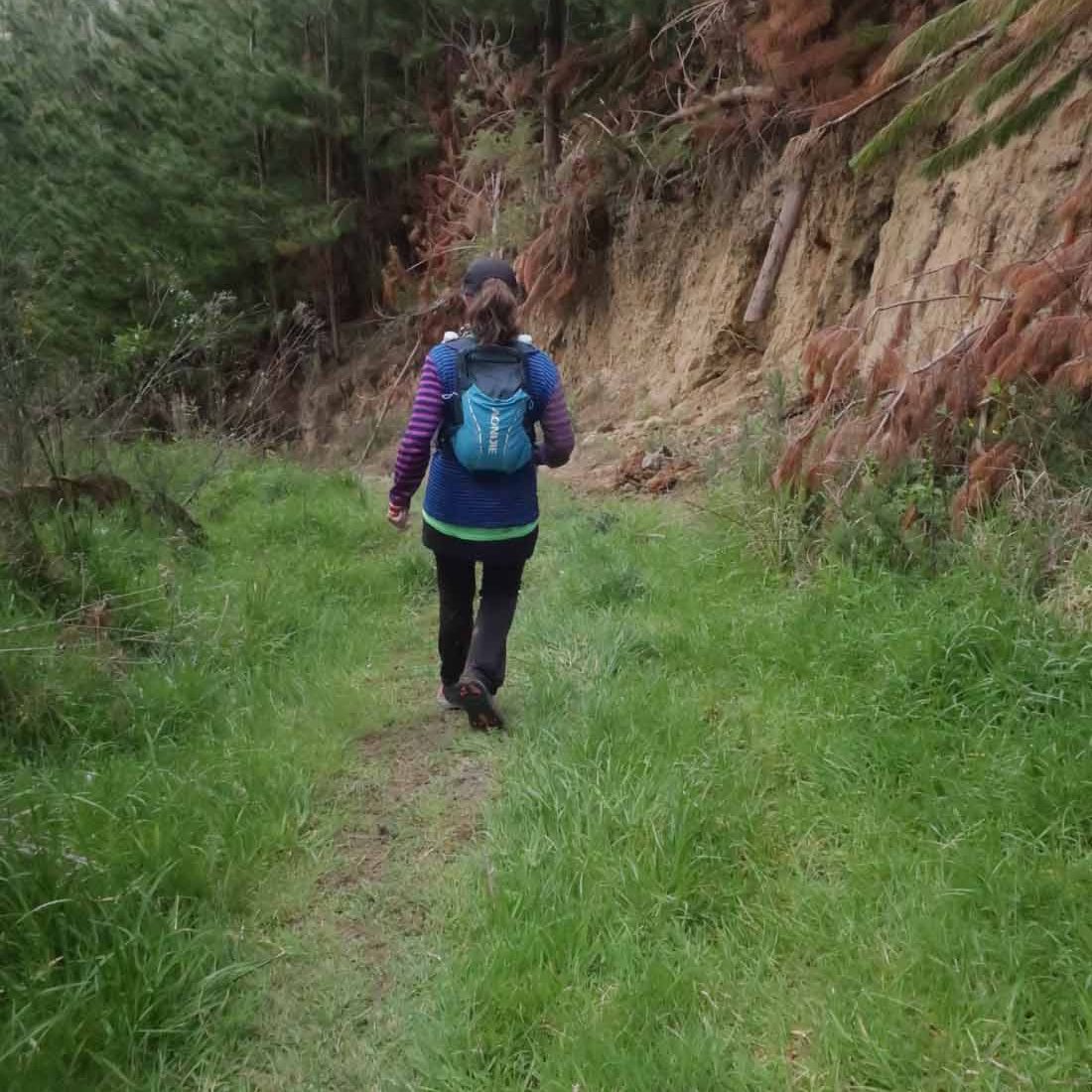
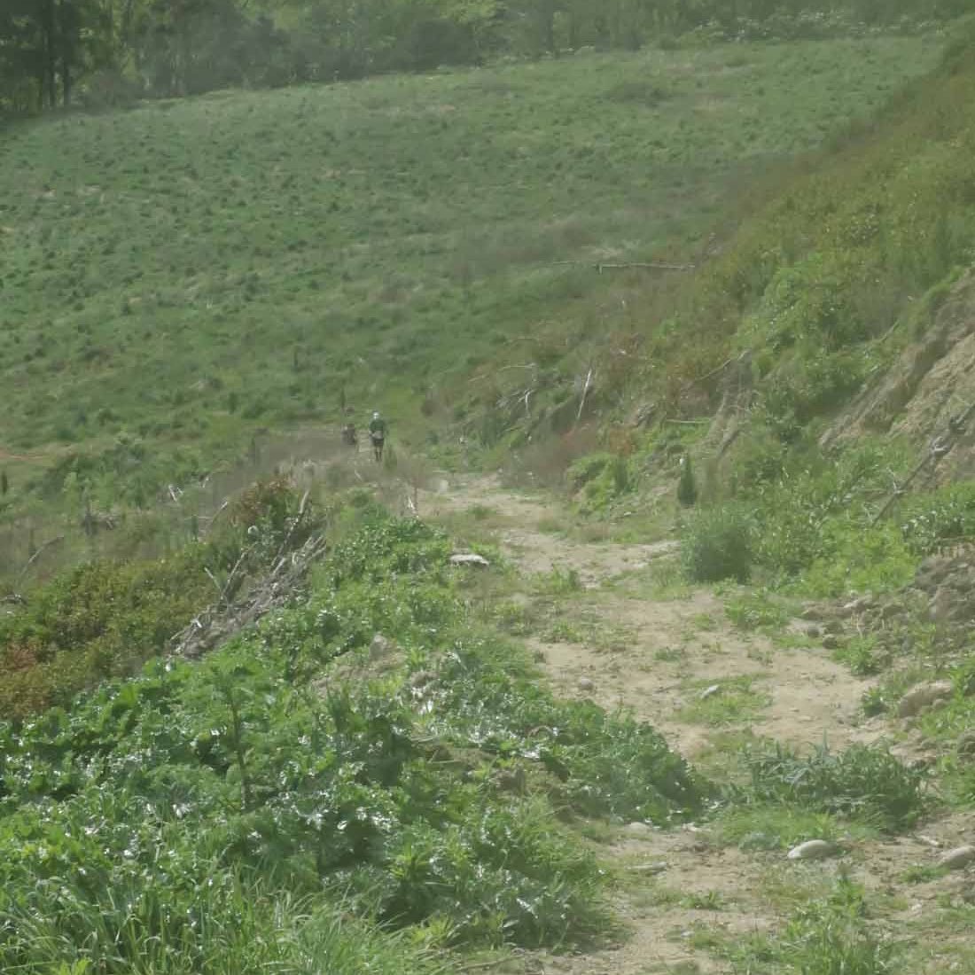
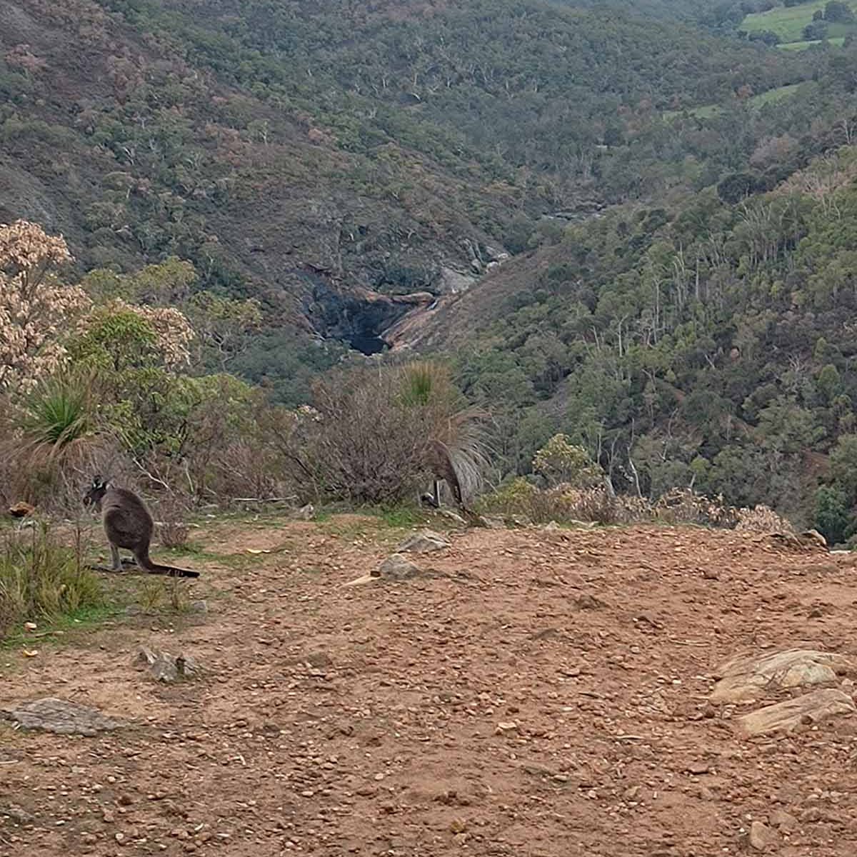
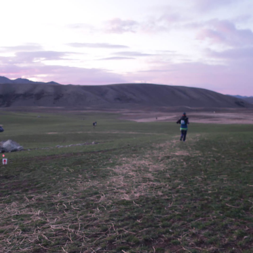
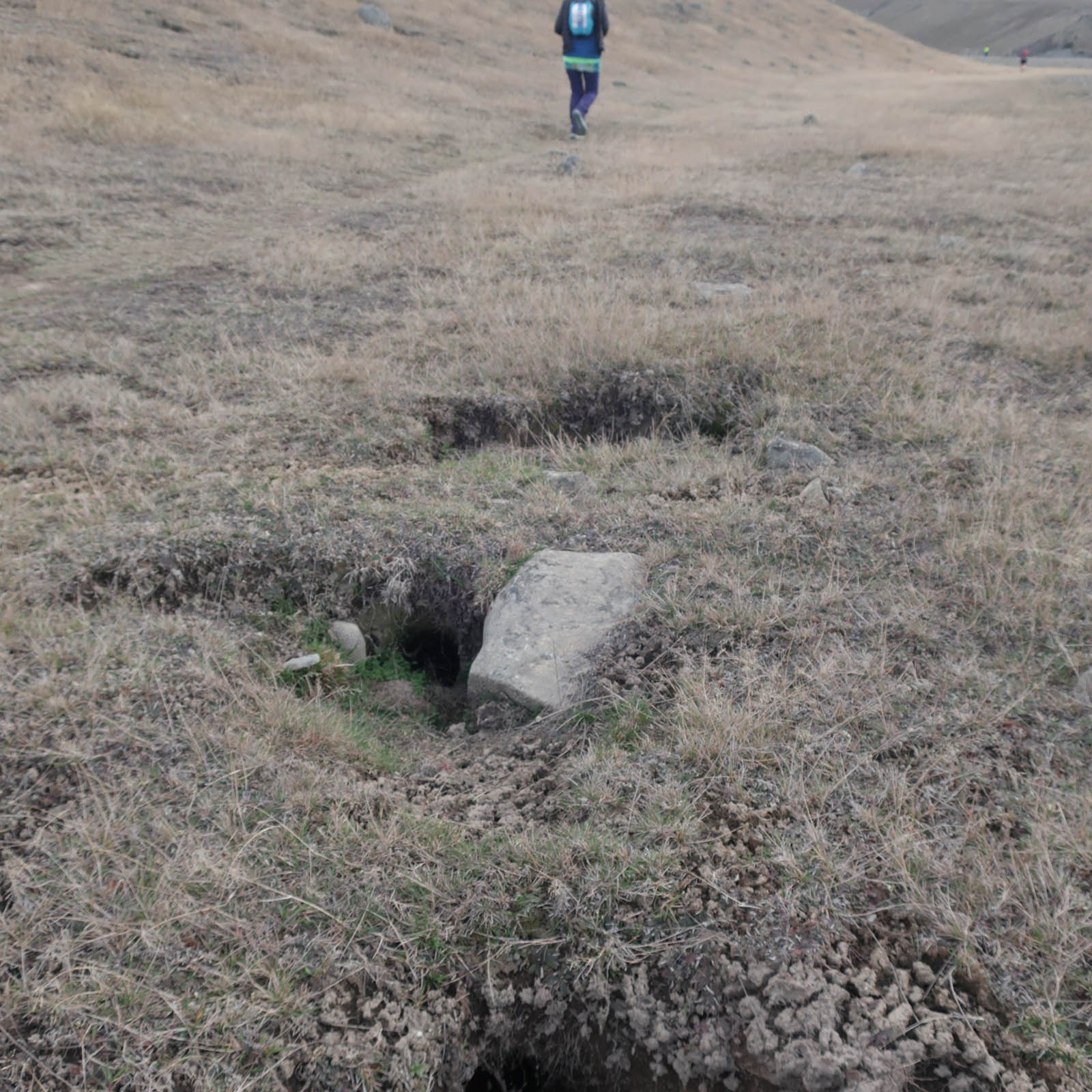
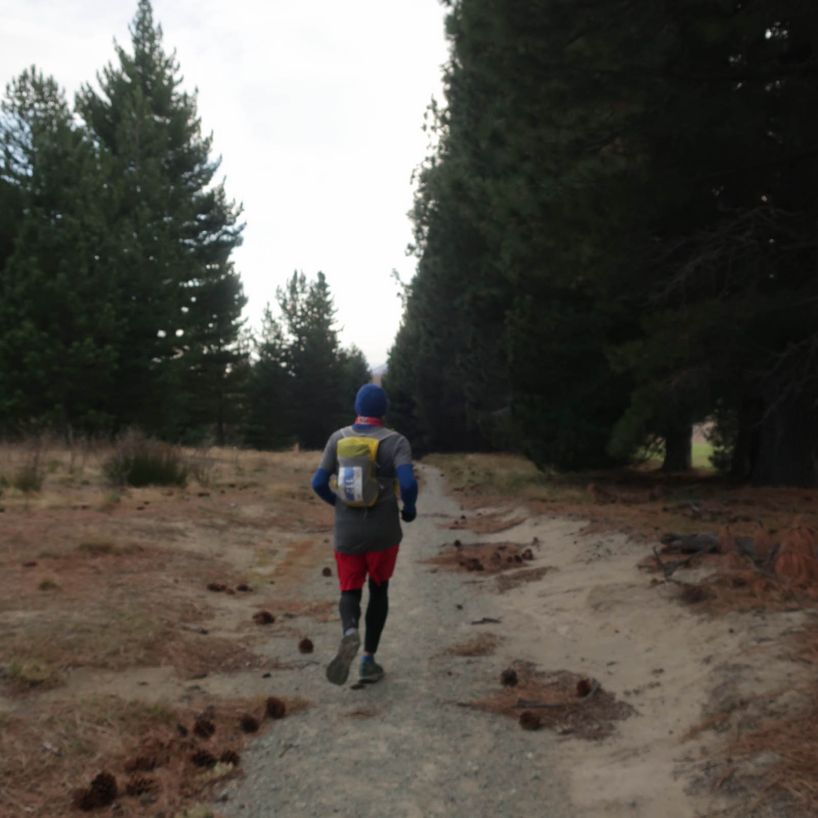
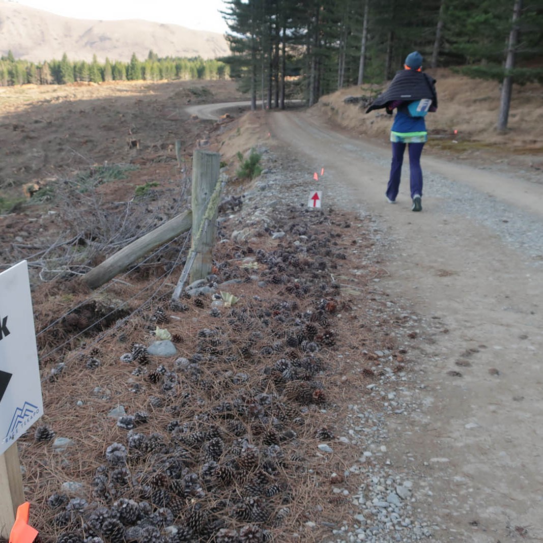
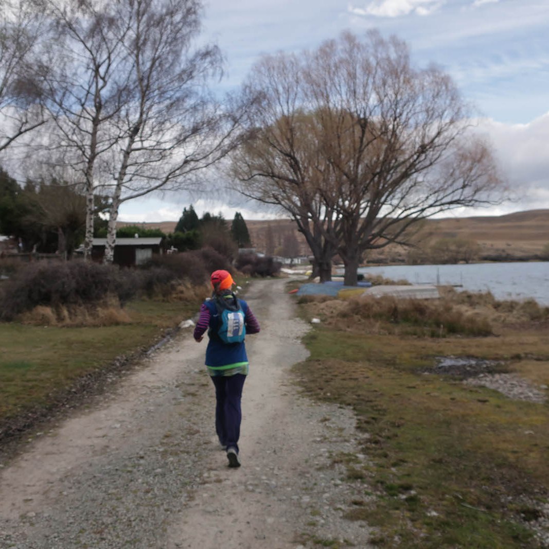
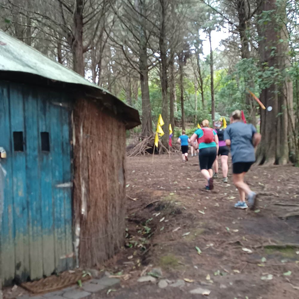
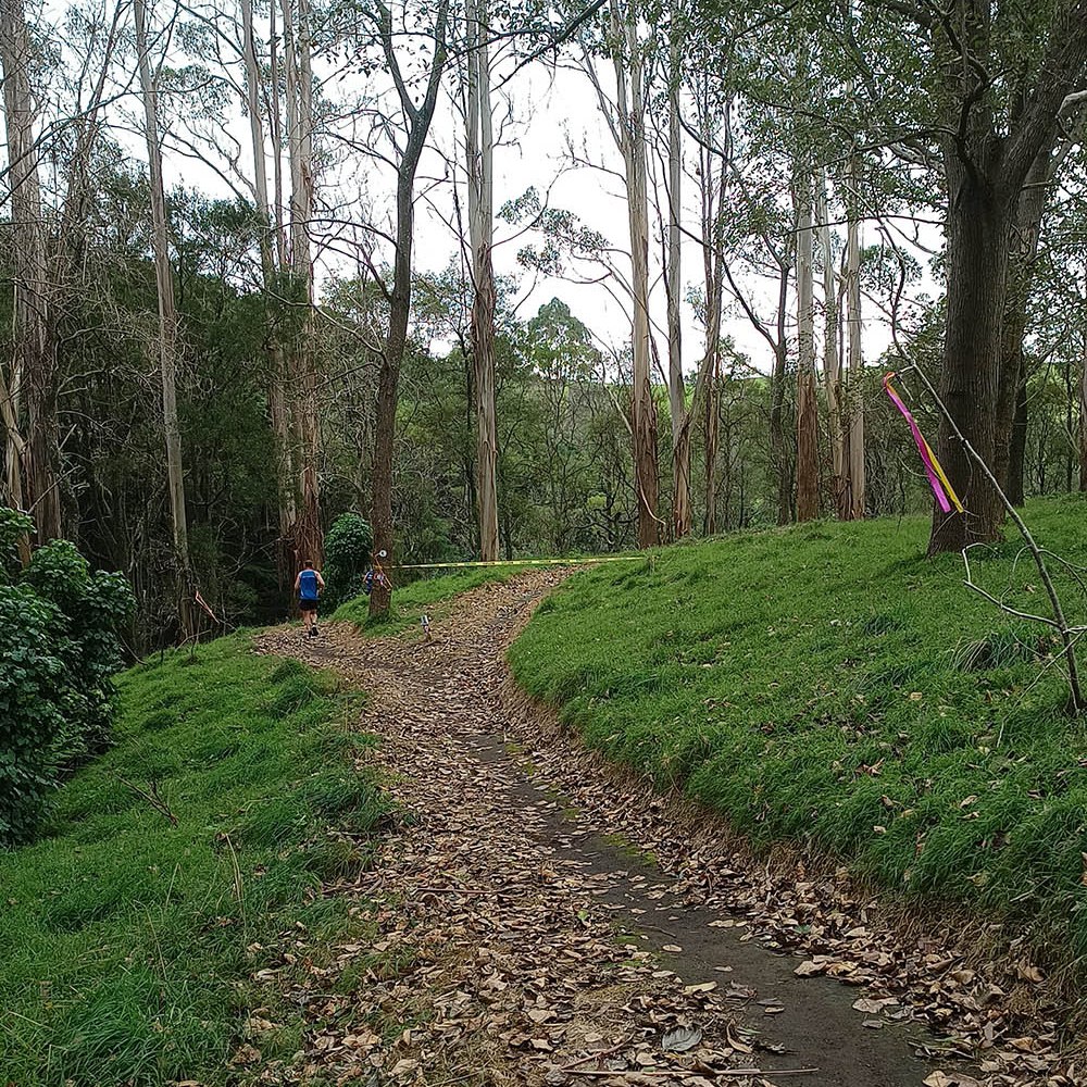
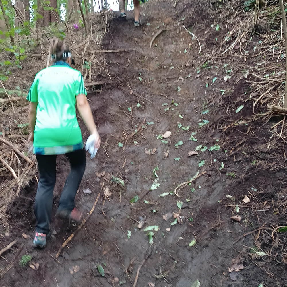
From the start we went straight onto the walkway next to the lake, across a footbridge, past the Church of the Good Shepherd, and into the forest. The sun was starting to rise and by the time we reached the first aid station just on the other side of the forest (at 3.7km) we could turn off our headlamps. We ran a big loop in what looked like a paddock. Huge rabbit holes were strewn across the field, which reminded me of a time when I was 13 years old when I stepped into some animal’s burrow and nearly disappeared down the hole. I was in agony afterwards from spraining a few things, and to this day I wonder if that had anything to do with my wonky spine.

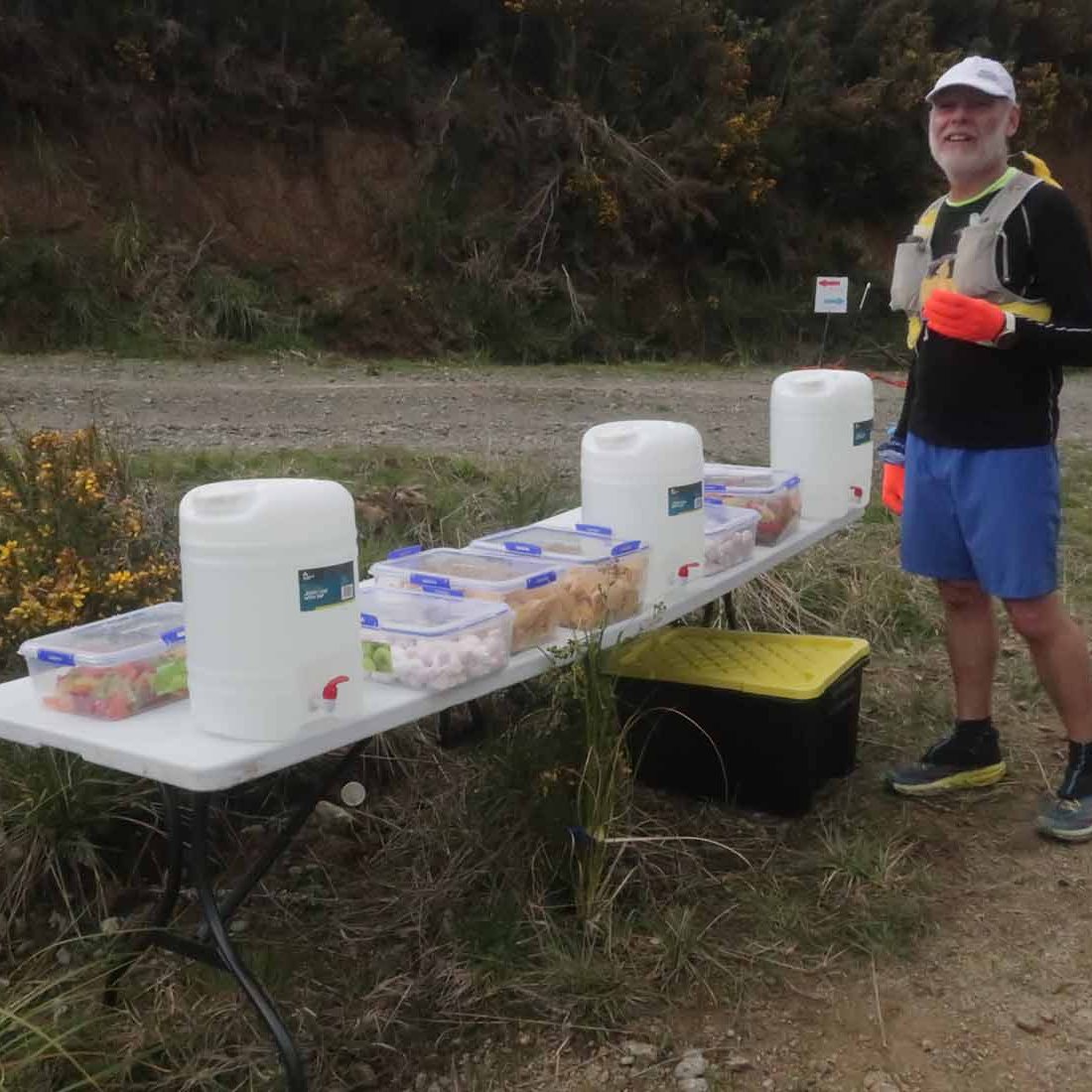
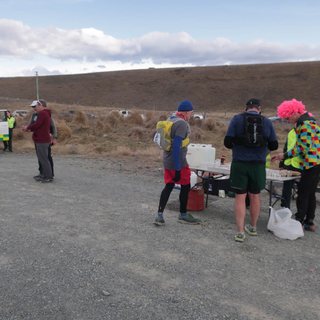
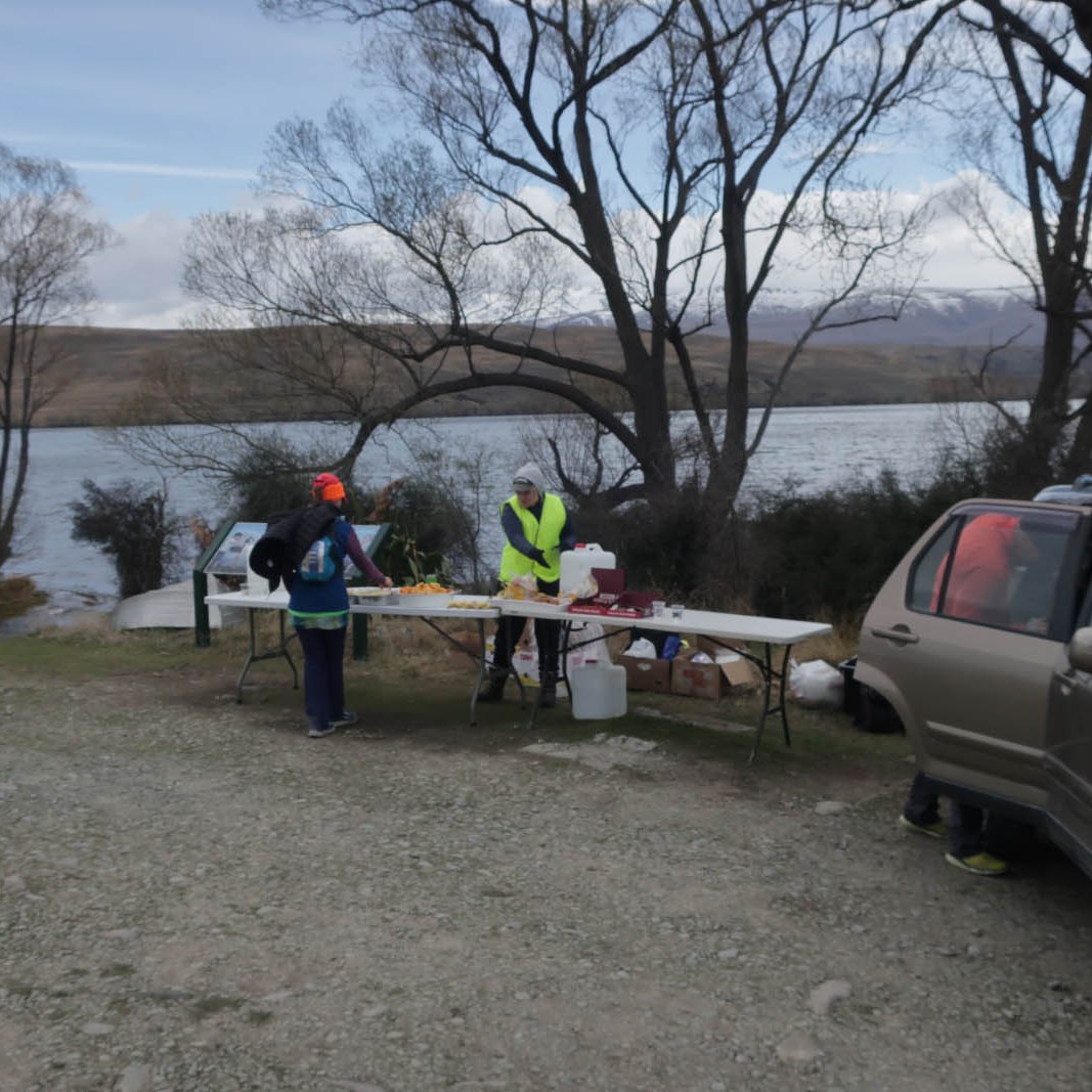
Back at the aid station, we stuffed ourselves with the wonderful spread of oranges, Heartland chips, Pam’s jet planes, and biscuits. The chips and jet planes were gluten free which was fantastic. Normally I can’t have anything at aid stations as most jelly sweets do contain gluten, and we have to carry our own sustenance.

We were going quicker than I anticipated, doing the first 10k in 1:15. Considering it was nearly flat and very easy underfoot, one could go at speed. But this was meant to be an event for us to take easy, not break ourselves, and just enjoy a long day out. But of course doing the first 10 so ‘quick’, I figured we could potentially try to do each 10k in one hour thirty minutes, to finish in about 7h30. It is still reasonably slow, and shouldn’t have a long tail of recovery. We had 15 minutes in the bank for when we have to go over Mt John, which would no doubt slow us down.

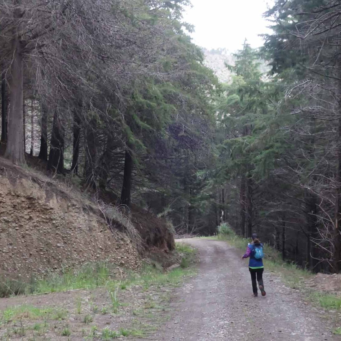
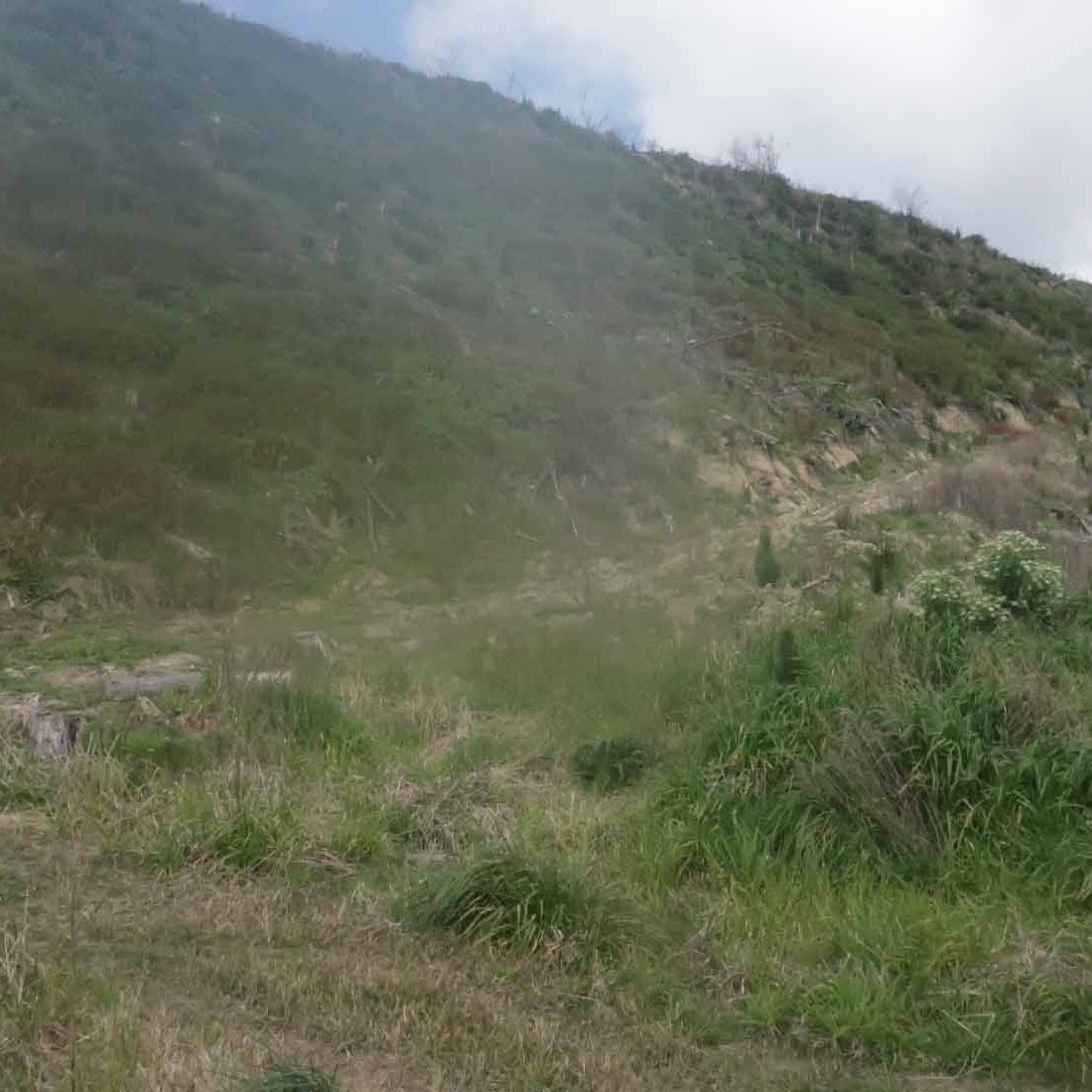
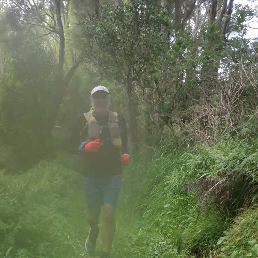
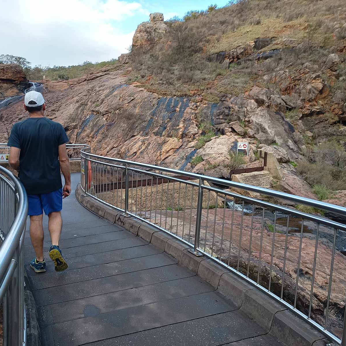
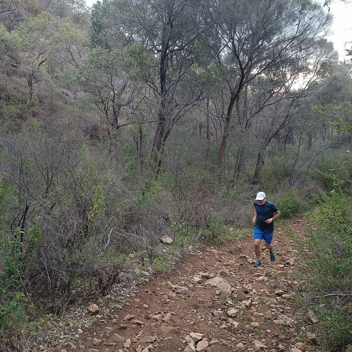
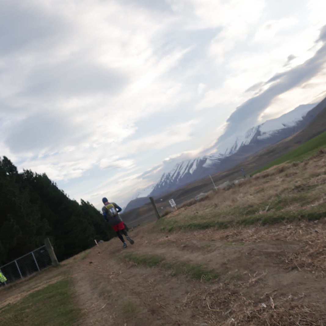
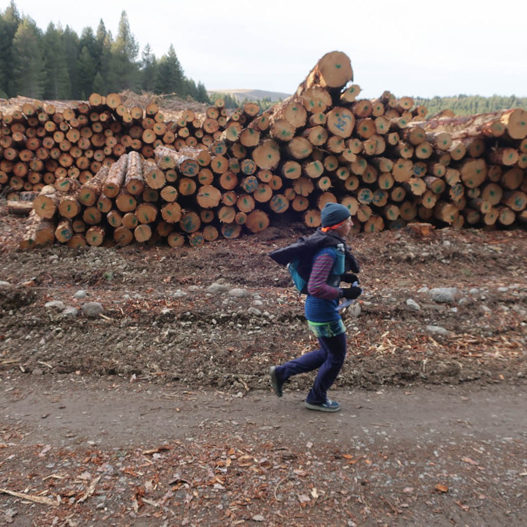
After a whirl around the forest of which parts are being felled, we headed back long the edge of the lake towards the start at about 21k. Passing next to the start/finish area, we topped up our waterbottels, feasted on the spread, and headed off towards the mountain. Although it is only about 300m elevation, the ascent is over a 2k distance – quite steep with no respite. A big part of the ascent was also in a forest and sheltered from the wind. But once we popped out above the forest, it was rather windy. And cold. I’ve started with five layers, got down to four layers, but had to put on my fifth layer again. My buff and beanie hadn’t come off yet, and neither the gloves. With a 6am start, it was still early in the morning and very cold. The poor marshals out on the course and on the mountain, just standing and waiting, must have been freezing.

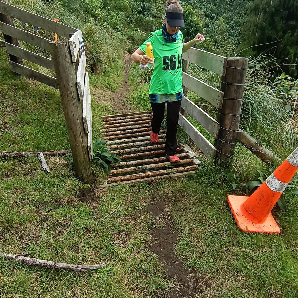
Once partway down the other side of the mountain, we were diverted onto a sealed road that took us on a steep downhill to the aid station at 28k. We opted to have a dropbag there with more sustenance, some gherkins and prosciutto. We also added rain pants to the dropbag incase the forecast came true and it started to rain at 1pm. We passed the aid station twice (again at 43k) and could access these items on any of the two occasions.

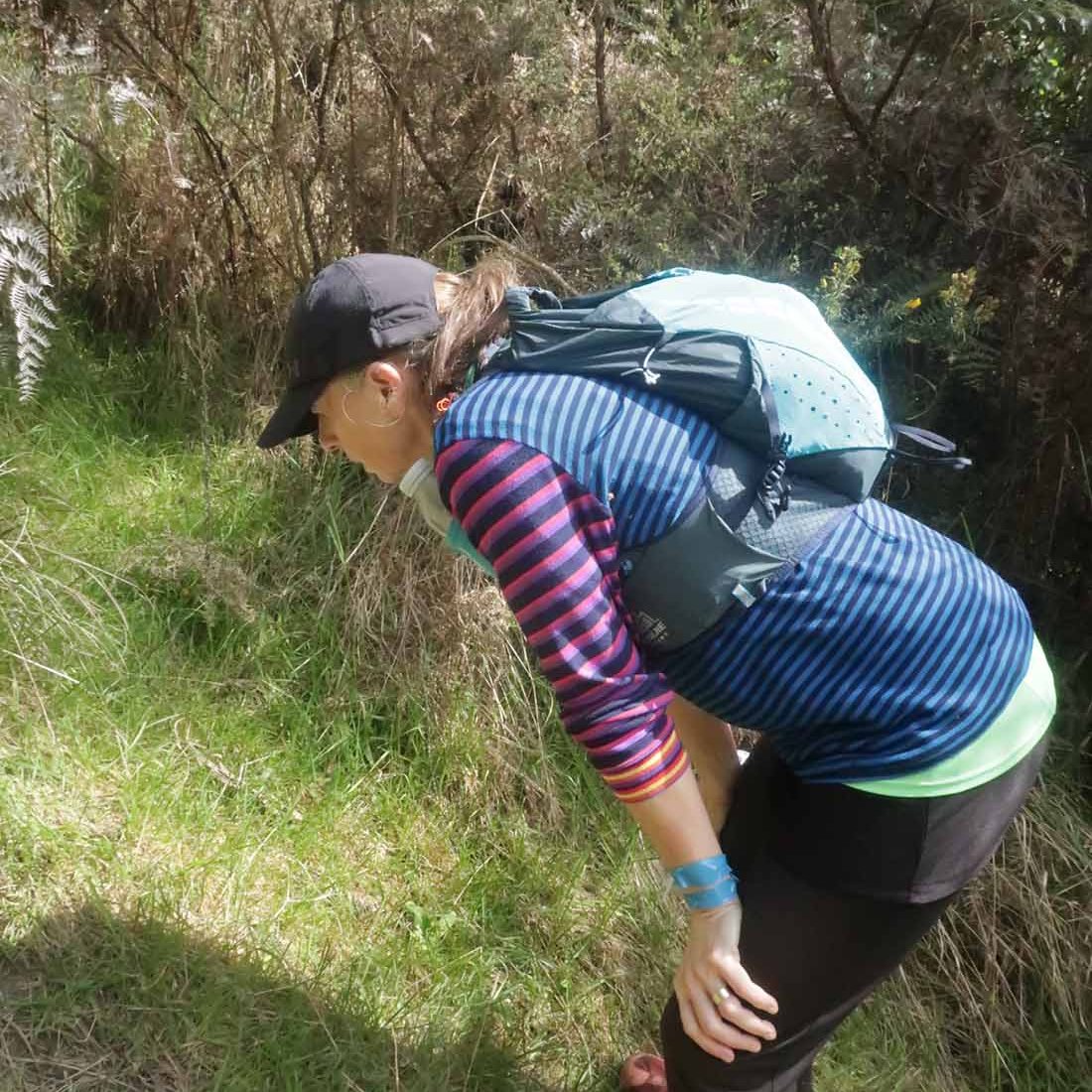
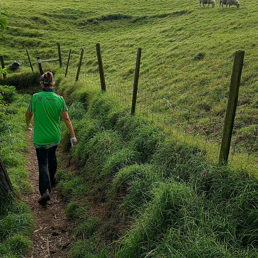
Past the aid station, we took a right to run down another sealed road for another couple of kilometres before being directed back onto the trails. We were running downhill towards Lake McGregor, followed by a long stretch next to Lake Alexandrina. At about 33k on a grassy patch, my feet caught on thin air and I took a roll in the meadow. Luckily there weren’t rocks and the landing was fairly soft. However, all my weight came down on my right arm, which felt quite sore afterwards. Fingers and other joints could still move, albeit sore, so I figure nothing was broken despite the pain.

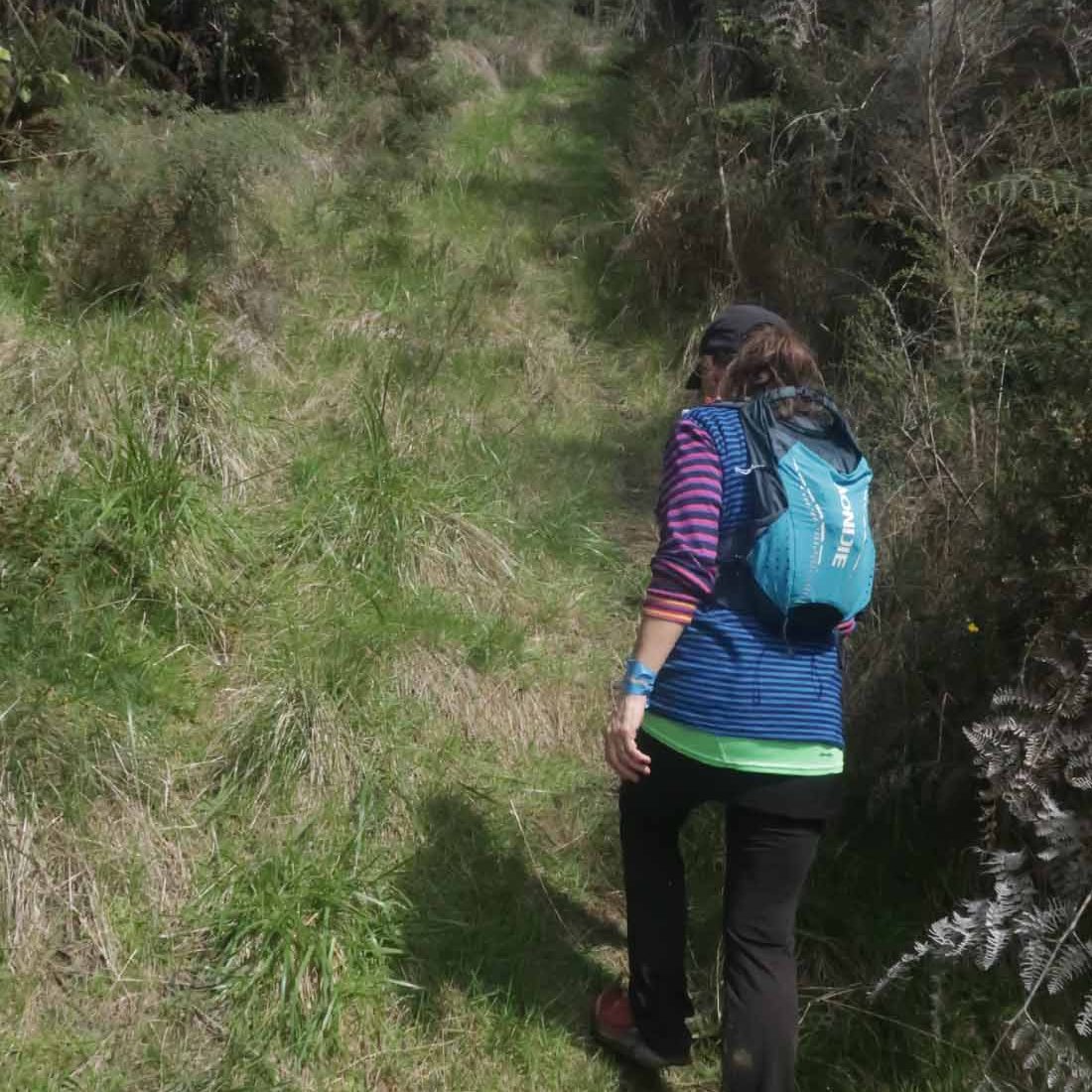
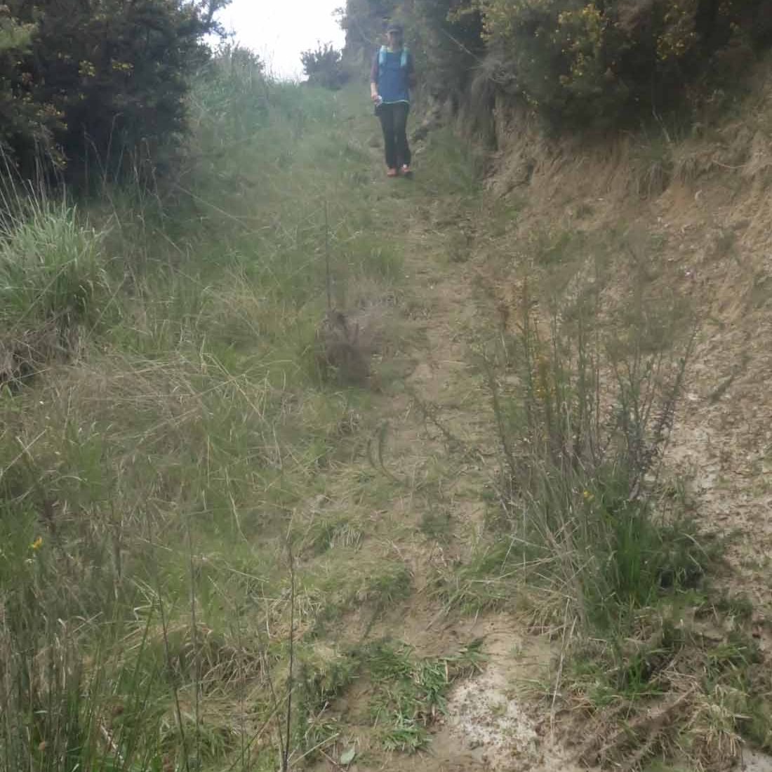
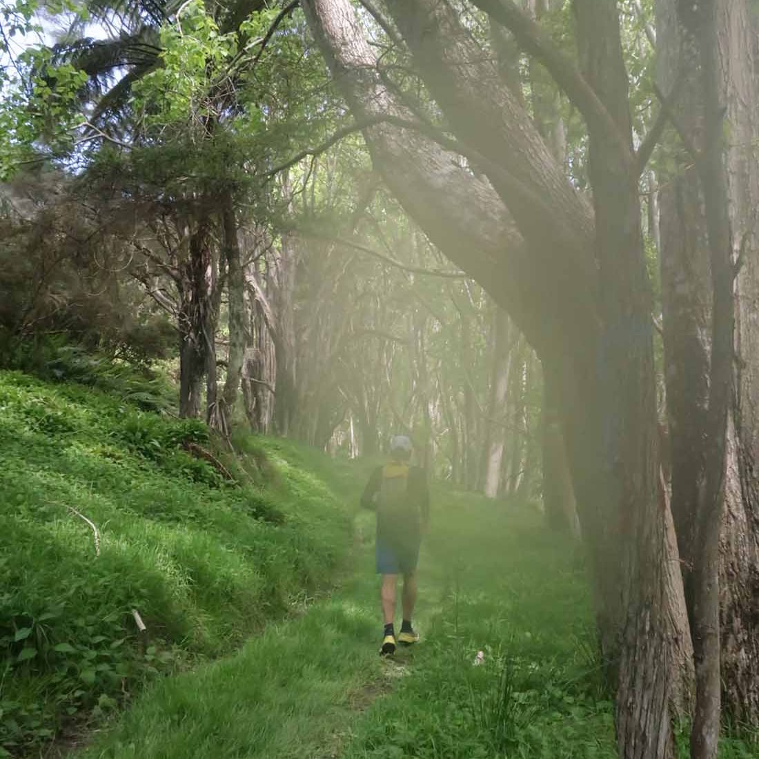
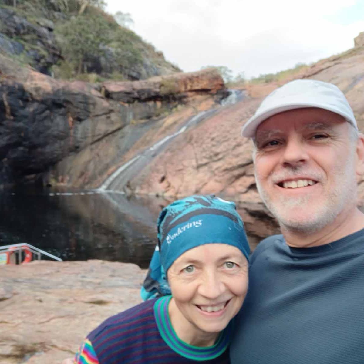
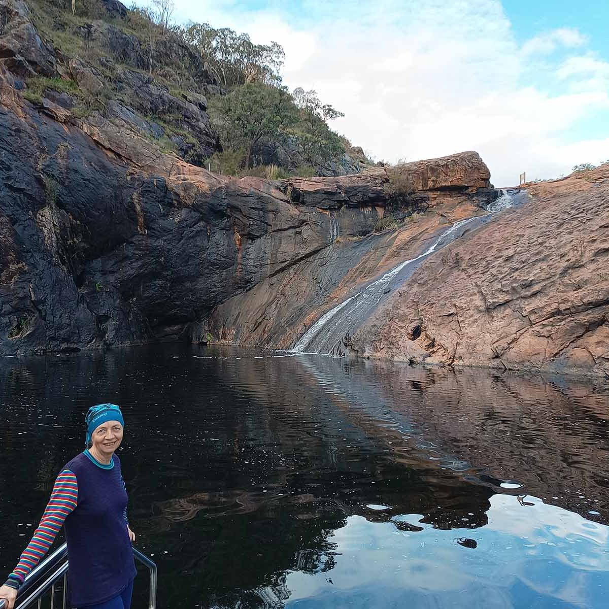
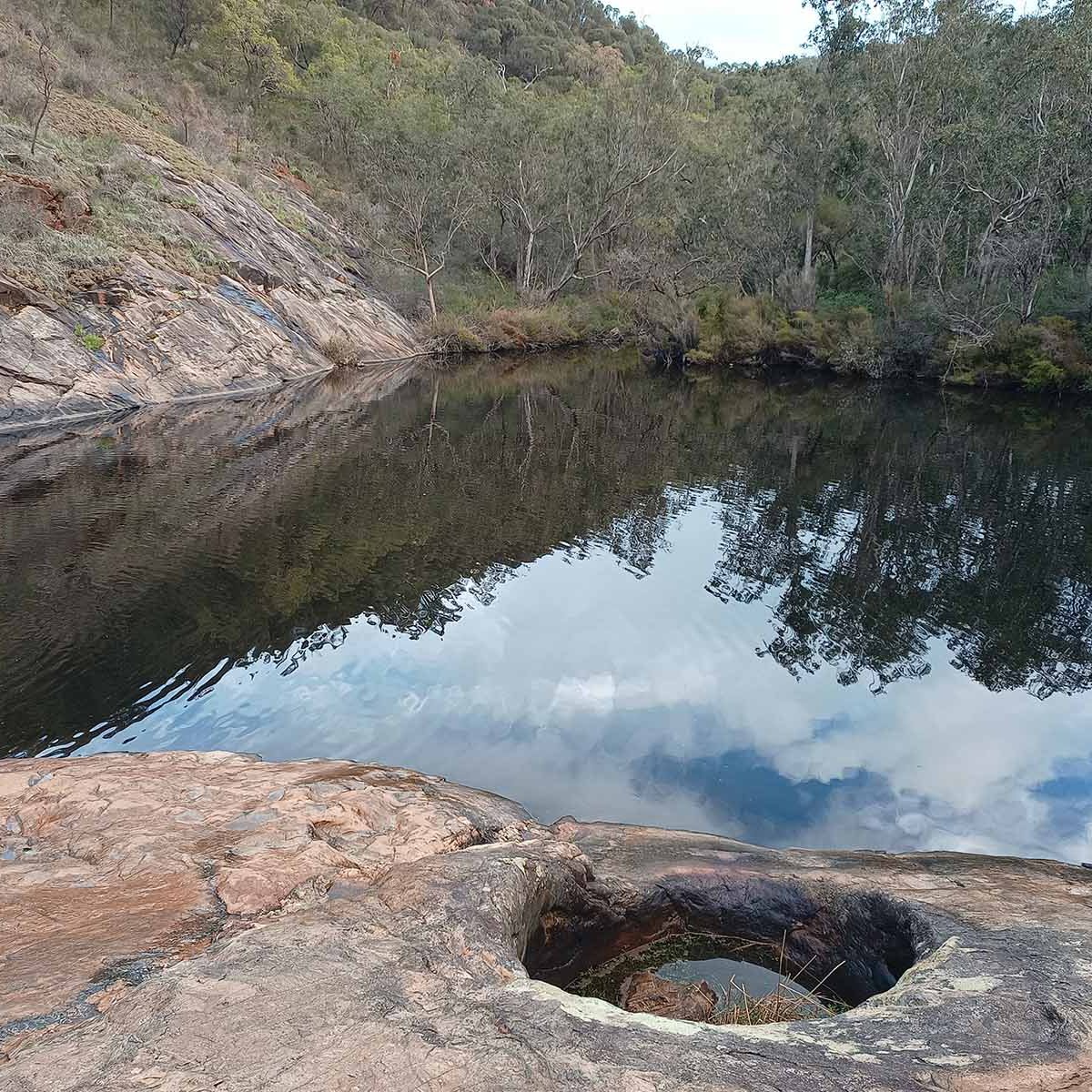
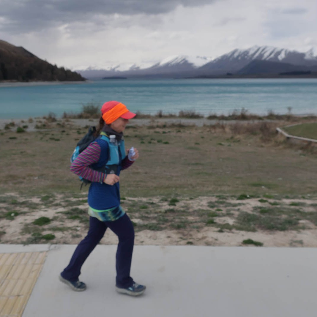
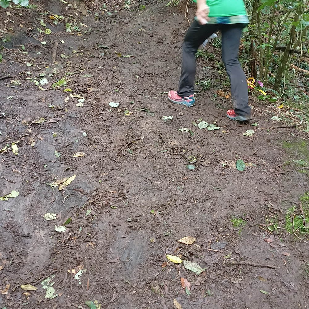
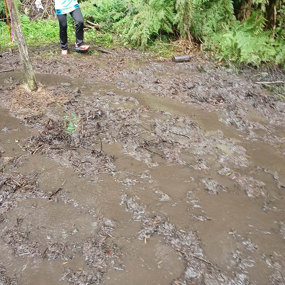
The stretch next to the Lake Alexandrina felt like it went on forever. At times the track was quite cambered, on top of being quite narrow, making running a bit more challenging. But having said that – this is the easiest most runable 50k I’ve done so far. Apart from the (about) 5k of steep climbs, the whole course is reasonably flat and easy underfoot. Some rocks in parts , and the potential for slippery mud on the downhill coming back off Mt John, but mostly very easy terrain.

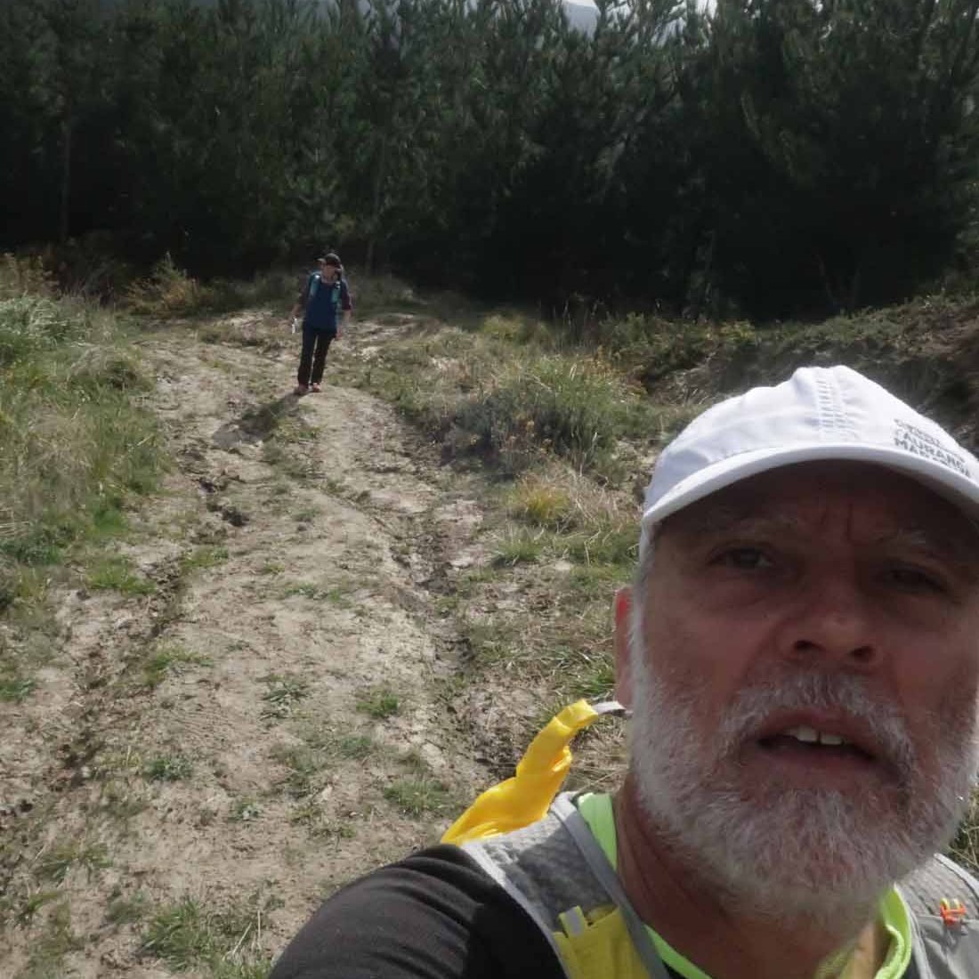
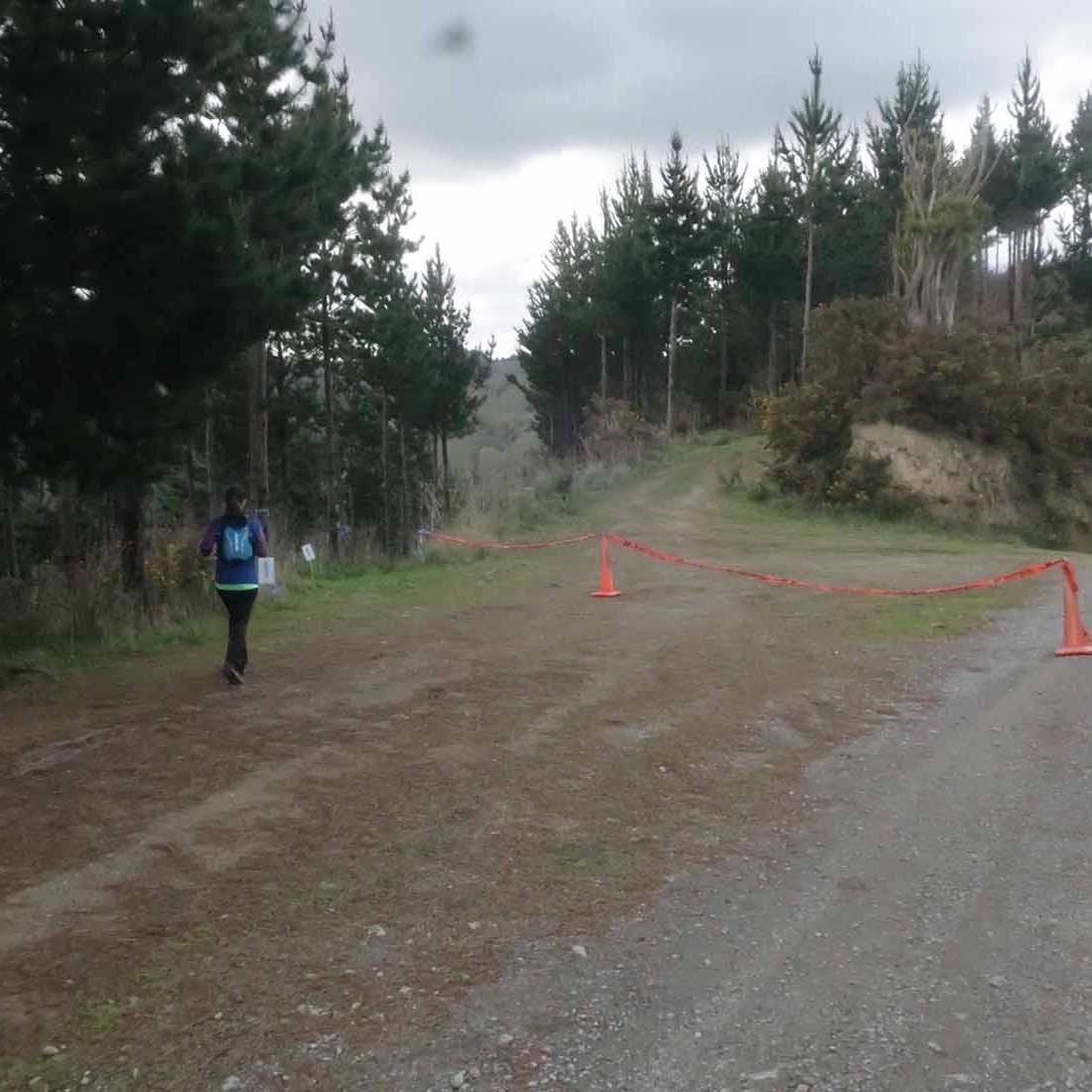
We exited from the Lake Alexandrina trail at about 41k, to follow a gravel road back to the aid station at ’41k’ (it was at about to 43.5k). Still filled up from all the goodies at the aid stations we didn’t bother with our drop bag. Moved it to the ‘used’ pile and started on the uphill again. Despite the wind and it being reasonably cold, I took off my fifth layer (a thin down jacket) and gloves and put it in the outside pocket of my hydration vest.

At the top of the incline (about halfway up Mt John again), and with about 6k to go, we dropped down the other side, making our way to the finish. We passed a couple more 50k runners and a few of the 32k runners in this last stretch.

Unfortunately, somewhere in the last 6k, my little down jacket and gloves blew out of my bag and into oblivion, I guess. I hoped that another runner who may have come across it, might pick it up and hand it in, but sadly I haven’t heard anything yet (nine days later). Still crossing my fingers, but not holding my breath.

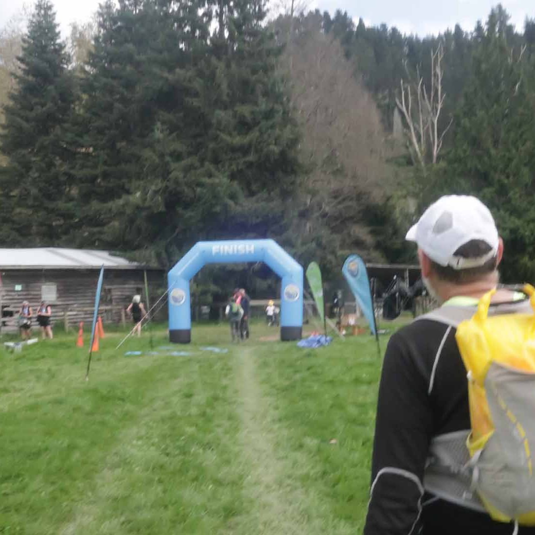
At the finish it was blowing a gale. We were wet from sweat, and started cooling down quickly. This was when I noticed my jacket was missing.

Gerry bought us mocchas at the coffee cart, we collected our dropbag, and started walking the 1.2km back to the lodge. After a shower, we headed back to the track and walked about 3k back along the course to see if we could find the jacket, but no luck.

With the horrible wind, prize-giving was moved from the race village next to the lake to the community hall where we had registration. Unfortunately this was so small that more than half the people had to stand outside, unawares of what was going on. When the numbers for the spot prizes were called out, the bush telegram were passing the numbers around outside the hall.

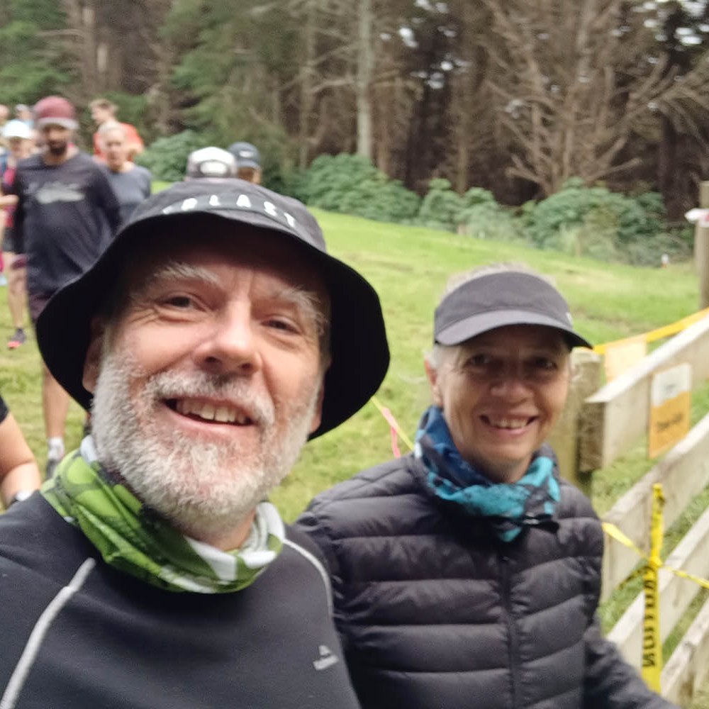
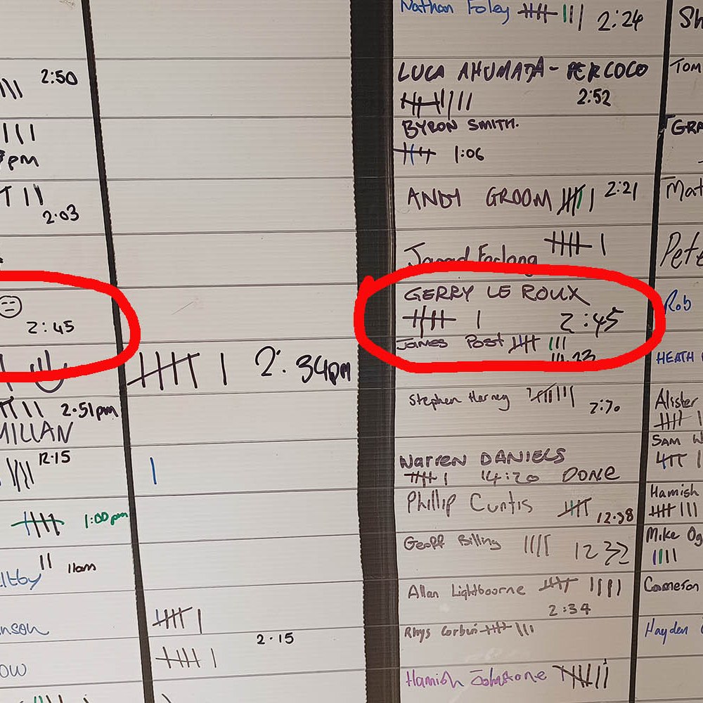
Afterwards, while people were bursting out the doors, we headed inside to find the white board with bib numbers written on it for minor spot prizes. Gerry got a spot prize and picked a pair of Creeper wool toe socks for me, which I can’t wait to try out. He also got a couple of free beers.

We headed home to cook the meat we bought, boil some potatoes and have salad, washed down with a red. By then my arm was so sore that I was certain something was fractured or cracked. I could not use it at all, and moving it in certain directions was pure agony. And everything else was more sore than I hoped it would be. Our latest long outings where we walked most of the way, meant I wasn’t very sore afterwards and recovered quickly. But we jogged more than I planned during this event, which resulted in more pounding. We were near the back and I felt bad for keeping the volunteers waiting in the cold, even though we made the ’41k’ cutoff with more than an hour and a half.

This remains the challenge in the NZ running scene  – people don’t want to participate if they’re not fast. Which means that running isn’t really inclusive. This would be a very good event for someone new to the distance, but with only a 121 participants in the 50k (6 DNS and 4 DNF) and a winning time of 3:49 (male), 4:06 (female), the field is very spread out and the back of the packers are few and far between. The slowest time was 8:48.

If we lived on the South Island I would do this event every year. It’s easy enough, great underfoot (when not wet), and fantastic organisation. The aid stations are wonderful, the course is well marked, and the event branded Thir headband was just the cherry on the cake.

During the night the wind picked up even more (is it even possible?) and it started to rain. The wheelie bins with giant rocks on them at our lodge blew over, and things looked terribly grim in the morning. I counted my lucky stars that race day was the day before things turned really nasty. We started gathering all our stuff, and packed for the road trip back to Christchurch. A quick drive through the village (we usually just pass through on the main road), while it was raining coupled with strong wind, before taking the highway. This time we decided to take the scenic route back, which to me looked the same as the other road. Or did I miss something?

We stopped for coffee at the one horse village of Burke’s Pass, but after a look around we ended up leaving without coffee. We drove past Kimbell, visited The Garage Gallery, and later stopped for filter coffee at the Fairlie Heritage Museum.

After taking the rental car back, we checked in at he airport and waiting for our turn. People were milling around and I dreaded the thought of having to fly in the horrible wind. The tail end of some of the strongest winds ever recorded in NZ (246k/h at Cape Turnagain, on the eastern side on the North Island) was blowing outside as we were waiting to board the plane. I found it hard to imagine flights were going ahead in the atrocious conditions.

Taking off was quite bumpy and a lot of turbulence. It was scary, but as we approached Wellington, it just got worse. I didn’t want to look, but the last time I did, the see was white and the water obviously super choppy. I closed my eyes and hoped for the best, when the pilot suddenly pulled up full throttle only to make a U-turn and head back to Christchurch. Three planes before us were already diverted, as were flights to Dunedin. All these flights were going to Christchurch. The landing was, given the circumstances, not too bad, but not the kind one would like to repeat.

With long queues of passengers trying to find out what next, emotions were running high and people were grumpy. Luckily Gerry was nearer the front end and could get a flight back to Wellington the next morning (it seemed almost too soon, as the stormy weather was still lashing the country), and also a nights accommodation at the Sudima Hotel. As we walked the 400 metres to the hotel, we chatted to another lady who was diverted from Dunedin. I couldn’t help but think to myself; what if the weather was so atrocious everywhere and there was nowhere to land? Which made me angry that the airlines took the chance in the first place. But I’m assuming they know what they are doing.

While we waited at the hotel to get helped, we bought a glass of wine at the bar, and just revel in being safely on the ground.

The next day we had breakfast at the airport, while our flight was delayed three times, in order for the wind to die out a bit. It was still blowing strong, but the water was less choppy and the landing was, again, not too bad given the circumstances.

Back home, two massive branches of a pine tree fell on the chicken coop and caused a lot of damage. The tree lost its central leader while it was still a small tree 14 years ago, and grew a heap of branches in its place. Some of these have the circumference of a pregnant sheep, and it was one of these that came down. The havoc it caused is immense: a row of Puhutekawa threes are all flattened on the one side, and some lost all branches. Our remaining apple tree (the other one drowned during winter) took a beating on the one side and some other indigenous tree are also damaged. The amount of work to clean up is vast, and will take a long while before we will have it all done.

Unfortunately, my arm (the one I fell on) took a turn for the worse. By the Friday after the event, I went to a doctor as I was sure something was cracked of broken. Turns out it must be torn ligaments and/or muscle. I was referred to the Hand Physio, but could only get an appointment in ten days time.

In the meantime, I’m pretty useless, and battle to see how I’m going to get everything done that need doing in the next couple of months (school work, cutting grass, pruning olives, cleanup pine tree, fix chook house, and the list goes on). On top of everything, I also picked up a cold of sorts, so no running anytime soon.

That’s the way it goes. Life will throw curve balls. We just need to figure out how to catch them.

Summerhill Skedaddle, Papamoa, Tauranga

Date: 14 May
Distance: Approximately 30km (we measured 34km)
Time: 5:45

The most fun you can have on winding, super hilly, muddy bike tracks, without a bike. Until it is ‘fun’, but not fun anymore.

This was the fifth running of the Summerhill Skedaddle (not to be confused with the new Skedaddle event on the South Island). The event runs on mountain bike trails in the Papamoa hills of Tauranga, and I have no doubt the organisers picked the most hilly trails in the park. When I saw Chris Townley at the start, I should have known something was up …

The format is as follows: it starts at 9am and finishes at 3pm, the course is a 5km loop, which you can run as a two-person team, a random Skedaddler, or a solo Skedaddler, and the aim is to complete as many (or as little) loops as you want. The randoms arrive when they want, start when they want and do as many loops as they want. Everyone gets a medal and a beer.

Apart from the teams (and there were many of them), the solo runners numbered 38 men, and 24 women. Random skedaddlers tallied 212, and a maximum of 500 participants are allowed. At a guess, I’d say we were between 300 and 350. The female record was eight laps, broken this year by Caitlin Knox to make it nine (phenomenal on that course!) and the male record remains at ten laps.

When you don’t know what to expect it is very easy to make up numbers beforehand. Like, six hours are allowed, maybe I can make 40km if I jog some and walk the rest. I honestly thought that 5km per hour is totally doable and a bare minimum, therefore easily completing 30km. Turns out, 30km was quite a challenge!

We’ve had some terribly hectic weeks, and this event and trip to Tauranga (some six plus hours drive one way) could not have been more badly timed. However, we were keen to experience this event and it was also a chance to catch up with our good friend Rob. We haven’t seen him since 2019, and it was about time we do an event together again.

With too much wine the night before, a bit of a hangover (thank goodness we sorted our food and drinks beforehand), we arrived not so bright and early at a very festive event base – a woolshed on the Summerhill Farm, owned by a private charitable trust established by David & Cloie Blackley on private land. After paying our dues and writing our names on a board, we queued for a last pee before getting to the start, which was in front of the shed. The start/finish farm track in front of the shed was lined on both sides by gazebos and tents and whatever people were using as setup to stash their sustenance, and shelter their cheering crews. Actually, each lap officially started and finished in the woolshed where you tick off your own laps, but the line of gazebos made for a nice ‘finish shoot’.

At 9am we were counted down and all participants dashed down a steep paddock to get onto the trails. I thought we were near the back, bit I guess we ended up somewhere in the middle. With around 300 runners on a single track, things are bound to be a little congested, and passing or getting passed was a bit tricky, so I tried to hold my place in the long line of runners. I was going okay, despite knowing we were running a bit too fast and I might regret it later on. I was delighted to see a toilet in the first kilometre in the pine forest and decided then that I would make use of it on the second lap. The toilets near the shed were a little bit out of the way, and super smelly. When I used these toilets before the start, I had to hold my breath, and figured the bushes will have to do for future pee stops. It was nauseatingly smelly. Turns out it the bush loo was a composting toilet and really not meant for large volumes (300 people!) of pee.

After the toilet a nice runnable kilometre, or thereabouts, on an overall downhill gradient that took us lower down in a valley where a super muddy section just got worse as the day went on (our photos were all from the first three laps, where that section was already pretty muddy. We forgot to take the camera, and the phone had to do – hence all the out of focus photos). On the first loop we could get through the mud not totally soaked, but by the forth lap, it was a soggy, muddy ankle deep mess, and slippery.

The first 1.5 kilometres is roughly on a downhill gradient, followed by a 1.8km stretch up and down over a hill in the middle of the loop, to finish with the last 2 kilometre on an uphill gradient. Not that that is an accurate description of the course. All around the loop there are short ups and downs to make sure it remains a challenge. A few short ups (three?) were super steep, an almost all fours kind of steep, and I was grateful we didn’t have to come down these. There is not a lot of flat areas, and add to this very windy paths, and the pace comes down considerably. Despite going flat out and ‘running’ what felt like the biggest part of the loop, we finished the first loop in 44 minutes. I knew right then that a loop an hour would be good for my capability at this stage of my training. That is if I could keep going for six hours, which was the main aim. We also needed to factor in the ticking off of laps, getting food and water, pee, etc.

We finished the second loop in 48 minutes, the third in 46 minutes, fourth in 51 minutes, fifth in 55 minutes and the sixth lap in 54 minutes. Which wasn’t too bad going, I think. We dilly-dallied about 48 minutes between laps all up (mixing electrolyte, topping up water and snacks, eat something, loo stops, and ticking off our laps). We opted to run with a small bag of snacks (jetplane jelly sweets, marshmallows, dates) and a small water bottle to have sustenance on the run. At our base setup we also had gherkins, prosciutto, bananas, date balls, sesame snacks, and electrolyte drink.

Adding to the festivities, were a bag pipe player near the halfway point which was also near the woolshed with sound carrying through the valley, and a lone saxophone player deep in the forest with beautiful sound akin to Lisa Simpson leaving music practice. Some wonderful jazzy notes to keep us going on the hills. At the base there was either music playing over the sound system, or live entertainment. As some runners only did one or two loops, or didn’t stay until after lunch, things quieted down somewhat on the trail for the last couple of laps, and the passing or getting passed got a bit less.

A burger cart was making what looked (and smelled!) liked delicious (huge!) burgers, so every time we finished a lap, people were stuffing their faces on the porch of the woolshed where we had to run through to get to the board to tick off a lap, which is pure torture. All I wanted to do was stop and be done with the pain. Unfortunately the burger lady had packed up when we finished, so no burger at the end. But happy with our medals, an iced tea for me, and beer for Gerry and Rob, we ate the last of our prosciutto, gherkins, and crisps, before I dragged my sore body to the car.

Gerry and Rob opted to help collect course markers, and although I was fully prepared to help, I realised within the first few steps that I was going to hold everyone up. To say I was buggered is an understatement. My muscles were completely spent, and for the first time ever I developed a super sore left hip (my FAI is on the right) on the fourth lap. It was especially sore going uphill, and I figured the problem must be muscle related. Admittedly I need to work on my strength, and it will become more important as we go longer.

The course was well marked with colourful ribbons and bunting, course markers and arrows, and entertaining props were scattered around the loop. Where have I seen that gorilla before?

The lowest point was at 120 metres above sea level, and the highest point at 204 metres. It is advertised as a free event, but effectively you pay what you want via a voluntary donation system, and the money is used to maintain the trails.

It is one of the toughest 34km I’ve ever done, and a timely reminder that we should get off the flat roads and into the hills. Not sure when and how, as it is not practically possible on a regular basis, but even once a month should help already.

The UTK (Ultra Trail Kosciuszko) that wasn’t

I thought perhaps I should just write a follow-up about our plan to run the 100 mile event in 2022.

Maybe because it is a new event and to entice participants into entering super early (it worked!), the event had the option to carry over your entry at no cost to the next year should you not be able to do it for whatever reason. And back doors are dangerous – when there’s a back door, one is almost guaranteed to take it.

In our defence we did try. We started with a bang and were doing very well for a few months, slowly building up fitness. Then my mum got sick, and we had to make the trip back to the motherland. Travelling around the world, and back and forth between our families for more than a month, took its toll. What was meant to be a crucial time in our buildup, ended up being a next to no training month. Coupled with all the stress of travelling, missing a connecting flight due to a stuff up by Qantas with the first flight, and having to postpone everything by a week, rearrange and rebook everything, eventually arriving without luggage, the stress of a sick parent, and the list goes on, training was the absolute last thing on my mind. Plus, that back door was wide open.

Arriving back, exhausted, to horrible weather (it seems to be getting worse) – non-stop wind and sideways rain – our enthusiasm for the inaugural event was all but gone. So we made the call to transfer our entries to this year. It is not a good decision to have to make. One’s self-esteem takes a knock and you feel like a failure.

Following the proceedings leading up to the event on FB, I was met with a mix of FOMO and relief. It was snowing up in the mountain in the weeks leading up to, and still a few days out from, the event and it started to look like the compulsory gear would have to be next level. Some lack of communication and other hick-ups by the organisers – GPX files were not made available and final course maps were not shared until the last minute, perhaps because the course had to be changed TWICE due to snow and safety of runners, details about aid stations, drop bags, pacers, support crew, etc – resulted in participants getting anxious and angry. Tonnes of entries were sold off and transferred, and things were looking to be in a bit of a shambles. At the same time, those who stuck to it could boast to be hardcore, have grit, and able to deal with whatever life throws at them. Ultimately, I suspect the course routes need some serious rethinking and replanning for the years to come.

But, fingers crossed, we can get our act together and line up at the start end of this year. We bought a new watch. The Suunto 9 Peak Pro to replace the old one of more than eight years. It was time. And with new gear comes renewed enthusiasm. We have a rough idea of what we need to do, and where we need to be with our training each month. The overall aim is to get out the door six days a week, to build up slowly, never to skip the long-run, walk heaps, and do the occasional speed session. On top of that, we have to start focusing on strength training and flexibility. My buggered hips and misalignment need all the help they can get.

To 2023! May it be a good year for health and fitness.