Date: 4 February 2018
Distance: 17km
Time: 3:04

A wonderful early morning outing.

A short section next to the highway at the start.

The early sections were in the shade, and quite cool to start off with.

Wonderful views all the way.

Dropping down to the railway line.

The distance markers indicate distances from station to station.

No shortage of stairs.

Kapiti island.

Fun times.

Not all track users were equally fast.

Benches at the highest point.

Good times.

A slip covering part of the track. Luckily there was a rope to hold on to.

Stairs, stairs and more stairs.

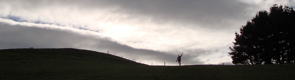
Kate striking a pose.

The swing bridges are quite runnable, as long as you get your rhythm right.

A muddy patch in the shade.

Heading down to another swing bridge.

This is what happens when you take too long taking a group selfie. 🙂

Easy running on the lower sections.

Passing right by the railway line.

A quick breather before Kate and Kel went on to catch the train, while Gary, Gerry and I ran back the same way we came.

It’s not just the views that take your breath away.
We finally got our butts down to Paekak (thanks Gary!) to see what all the fuss is about. With Gerry often working in Wellington for the past seven years, we were driving down a couple of times a month, and often more. And each time would be a reminder that we still want to go do it this walk which has been advertised far and wide. Everybody knows someone who has done it, if they haven’t done it themselves. But, getting over there would mean another trip, and quite frankly, I was getting sick of that road. At the end of last year, Gerry decided to let go of the ad hoc weekend job in Wellington, giving us a breather from a lot of the trips, and making it more bearable.
We decided to make an early start, so left Palmy shortly after 6am. Kate and Kel managed to come along at short notice so we all met bright and early at Summerhill Shopping Centre.
The track is just about in Gary’s backyard, so he often uses it for training. He invited us along previously, but something came up and we couldn’t make. This time we were not going to miss out again.
We started off at the Paekak end at about 7:30am. Crossing underneath SH1, we went straight onto the track and slowly started making our way up the hill. The first bit was mostly runable and not too steep, but once we reached the millions of stairs, I was reduced to a slow walk. The path is fairly narrow, and to be quite honest, I would not like to be up there on a windy or gusty day. You are quite exposed against the side of a very steep hill.
Luckily, it was the most glorious day, weather wise, and we were treated to beautiful views over Kapiti Island and the South Island. Since we were on the western side of the mountain, the sun was still low enough for us to be in the shade for the most part. Just as well, as things got quite hot later on without much of a wind.
We reached the highest point after about 3.9km, where a couple of wooded benches have been installed. The five of us were by ourselves when we got there, but on the way back it was packed with people making a day of it. The track also got much busier on the way back and we had to squeeze past lots of people on the narrow track.
After some photos of the scenery and selfies, we started going down on steps that were clinging to the side of the mountain, interspersed with the narrow track. I’m really not comfortable with heights, but this was somehow okay-ish. I’ve sidled around much hairier ridges in the past and this did not make my nerves stand on edge all the time.
At about 5.5km we reached a slip where a guide rope was put in place for safety. It did not fill me with confidence, and I’m quite surprised, given the terrain, that there aren’t lots more slips. Not long after we got to the first of two swing bridges. They are wide and sturdy, easy to run across if you don’t create a rhythm causing you to bounce out if sync.
The last couple of kilometres were easy, downhill and nice to run, and we reached the other end of the track at Pukerua Bay (after 7.5km) in about two hours. After a quick breather, and leaving Kate and Kel who took the train back, Gerry, Gary and I turned around to run back. There were already a fair amount more walkers and runners on the track, but soon it became really busy. Passing walkers going in the same direction, as well as passing heaps coming from the front, including quite a few other runners, made me glad that we started when we did.
This seems to be a hugely popular track, even if just to walk to the highest point for a picnic and lovely views, and back again. It is well worth doing, but I would recommend going early. The earlier the better.
Do it, if you haven’t yet.